FOR YOU, FOR FREE: 19 years' worth of firsthand Costa Rica trip planning and travel advice compiled into hundreds of articles, plus exclusive discounts.
Driving In Costa Rica: Distance And Duration Of Popular Routes
Article last updated on May 28, 2025. Note that an old date may indicate that an update is not required, not that the text is outdated.
Why predetermining drive distance and duration in Costa Rica matters
driving in Costa Ricadriving in Costa Rica
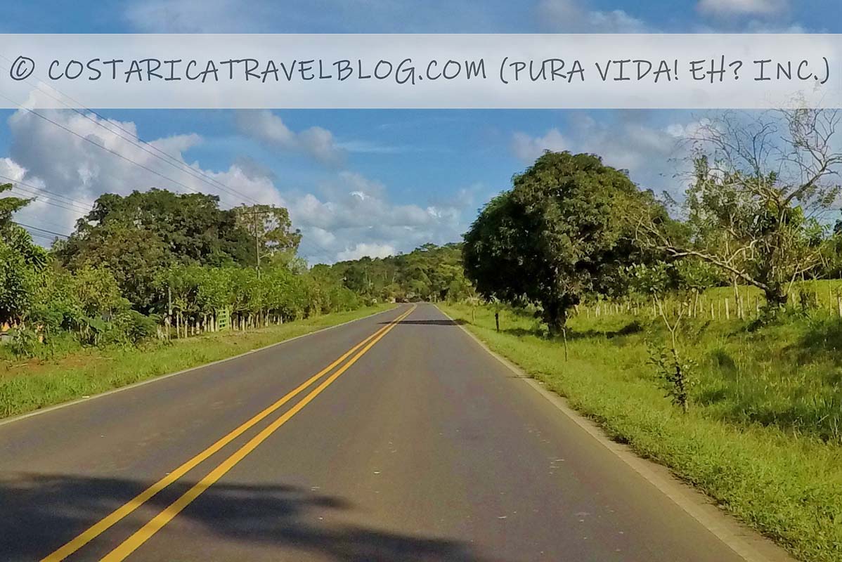
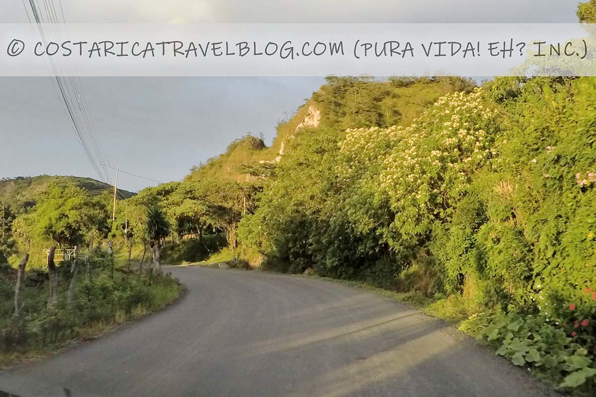
Costa Rica’s diminutive size can be deceiving. Though tiny, you’ll find no shortage of mountains, volcanoes, rivers, valleys, canyons, and cliffside communities here, plus plenty more obstacles for roads and highways to weave around. Rarely are drives conducted on straightaways, which means destinations that appear close to one another on a map may actually be tens or hundreds of kilometers apart (note that Costa Rica uses the metric system). For this reason, trips almost always take longer than you’d expect them to, and that’s not even factoring in potential delays caused by rough road conditions, poor weather, protests or celebratory parades, road construction, and other time-consuming encounters.
While you may not be able to narrow down exact arrival times, it’s important to obtain an approximate duration for each route you intend to travel while in Costa Rica. This information will help you best prepare for your trip. Knowing roughly how many kilometers and how much time separate the destinations you intend to visit can help you determine the following:
When you’ll likely need to stop for gasoline
When you’ll likely need to stop to stretch or use the bathroom
When you may need to stop to eat food along a route (assuming you drive over the lunch hour or the dinner hour)
The latest time of day that you should set out on any route in order to ensure you arrive at a destination before dark (6pm; driving after this time is not recommended)
Plans for hotel check-ins and check-outs
Whether you’ll have enough time in the morning (before setting out on a route) or in the afternoon (after completing a route) to participate in a tour or activity
Important notes about our approximate travel times
The average drive times listed below are estimates based on our own travels around Costa Rica. This being said, the duration of Costa Rica routes can be influenced by many factors, so it’s best to assume that your driving experience may be different than ours.
For routes cited below to take less than an hour, give yourself an extra 15 minutes when scheduling your trip. For example, if we suggest that a route takes 45 minutes to drive, assume you’ll arrive at your destination in no less than 30 minutes but likely no more than 1 hour. For routes that take between 1-3 hours to drive, give yourself an extra 30 minutes of buffer time, and for routes that take more than 3 hours to drive, extend that window to 45 minutes to 1 hour.
The average drive times listed below are for travel via direct (non-collective) ground transportation, ideally routes driven in a rental car. Routes traveled via shared shuttle service, private transfer service, and public transportation (i.e., local buses) may take more or less time than our approximations. Domestic flights, which are an alternative form of domestic travel in Costa Rica (see our related blog post Costa Rica Transportation: 15 Ways To Get Around Costa Rica for more transportation options), may also take more or less time than our approximations.
Note that each list below begins with San Jose, Costa Rica’s capital city. Following San Jose, destinations are listed in alphabetical order.
Highway help
If you’re interested in learning about the highways mentioned in our charts, including highway conditions, traffic, tolls, river crossings, 4×4-vehicle requirements, and more, please see the links directly below. Note that clicking on one of the highway links below will open our related blog post Costa Rica Highway Conditions By Route in a new window.
Highway 1, Highway 23, Highway 17, ferry ride across the Nicoya Gulf, the Nicoya Peninsula coastal road, and Road 624 *This route requires a ferry ride
140 kilometers (excluding distance traveled by ferry)
4 hours (excluding the 1-hour ferry ride across the Nicoya Gulf and additional ferry loading/unloading time)
Montezuma
Highway 1, Highway 18, Highway 21, the Nicoya Peninsula coastal road, and Road 624 *This route avoids a ferry ride
310 kilometers
5.5 hours
Nosara
Highway 1, Highway 18, Road 150, and Road 160
260 kilometers
4.5 hours
Papagayo Peninsula
Highway 1, Highway 21, and Road 253
240-255 kilometers
4-4.5 hours
Puerto Jimenez
Highway 27, Highway 34, Highway 2, and Road 245 *This coastal route avoids driving over Cerro de la Muerte
375 kilometers
5.5 hours
Puerto Jimenez
Highway 2, Road 243, Highway 34, Highway 2 (again), and Road 245 *This mountain route requires driving over Cerro de la Muerte
335 kilometers
6 hours
Puerto Viejo de Sarapiqui / Sarapiqui
Highway 32 and Highway 4
85 kilometers
1 hour and 45 minutes
Puerto Viejo de Talamanca / Puerto Viejo
Highway 32, Highway 36, and Road 256
215 kilometers
4 hours
Puntarenas
Highway 1, Highway 23, and Highway 17
100 kilometers
2 hours
Samara
Highway 1, Highway 18, Highway 21, and Road 150
240 kilometers
4 hours
San Gerardo de Dota
Highway 2 and Calle San Gerardo
85 kilometers
2 hours
San Isidro de El General
Highway 2
135 kilometers
3 hours
San Ramon
Highway 1
60 kilometers
1 hour
Santa Teresa / Malpais
Highway 1, Highway 23, Highway 17, the Nicoya Peninsula coastal road, ferry ride across the Nicoya Gulf, and the unnamed principal access road *This route requires a ferry ride
145 kilometers (excluding distance traveled by ferry)
4.5 hours (excluding the 1-hour ferry ride across the Nicoya Gulf and additional ferry loading/unloading time)
Santa Teresa / Malpais
Highway 1, Highway 18, Highway 21, the Nicoya Peninsula coastal road, and the unnamed principal access road *This route avoids a ferry ride
315 kilometers
6 hours
Siquirres (Pacuare River rafting tours)
Highway 32
100 kilometers
2 hours
Tamarindo
Highway 1, Highway 18, Highway 21, Road 160, Road 152, and Avenida de las Palmas
290 kilometers
4.5 hours
Tambor
Highway 1, Highway 23, Highway 17, ferry ride across the Nicoya Gulf, and the Nicoya Peninsula coastal road *This route requires a ferry ride
120 kilometers (excluding distance traveled by ferry)
3.5 hours (excluding the 1-hour ferry ride across the Nicoya Gulf and additional ferry loading/unloading time)
Tambor
Highway 1, Highway 18, Highway 21, and the Nicoya Peninsula coastal road *This route avoids a ferry ride
290 kilometers
5 hours
Tortuguero
Highway 32, Road 806, and boat ride through canals from the dock at Cano Blanco *This route requires a boat ride
135 kilometers (excluding distance traveled by boat from the dock at Cano Blanco to Tortuguero Village)
3 hours (excluding the 75-minute boat through the canals and additional boat loading/unloading time)
The unnamed principal access road, the Nicoya Peninsula coastal road, ferry ride across the Nicoya Gulf, Highway 17, Highway 23, and Highway 1 *This route requires a ferry ride
145 kilometers (excluding distance traveled by ferry)
4.5 hours (excluding the 1-hour ferry ride across the Nicoya Gulf and additional ferry loading/unloading time)
San Jose
The unnamed principal access road, the Nicoya Peninsula coastal road, Highway 21, Highway 18, and Highway 1 *This route avoids a ferry ride
315 kilometers
6 hours
Liberia
The unnamed principal access road, the Nicoya Peninsula coastal road, and Highway 21
215 kilometers
4.5 hours
Montezuma
The road to Delicias
15 kilometers
40 minutes
Driving from Siquirres (Pacuare River rafting tours)
to…
via…
is roughly…
and takes approximately…
San Jose
Highway 32
100 kilometers
2 hours
Cahuita
Highway 32 and Highway 36
105 kilometers
1 hour and 45 minutes
La Fortuna / Arenal
Highway 32, Highway 4, and Road 142
155 kilometers
2.5 hours
Limon
Highway 32
60 kilometers
1 hour
Puerto Viejo de Talamanca / Puerto Viejo
Highway 32, Highway 36, and Road 256
120 kilometers
2 hours
Driving from Tamarindo
to…
via…
is roughly…
and takes approximately…
San Jose
Avenida de las Palmas, Road 152, Road 160, Highway 21, Highway 18, and Highway 1
290 kilometers
4.5 hours
Flamingo (Playa Flamingo)
Avenida de las Palmas, Road 155, and Road 180
25 kilometers
30 minutes
Grande (Playa Grande)
Avenida de las Palmas, Road 155, Road 180, and Road 933
20 kilometers
30 minutes
Grande (Playa Grande)
Boat transport across the estuary at Rio Matapalo
N/A
5-15 minutes
Liberia
Avenida de las Palmas, Road 155, and Highway 21
75 kilometers
75 minutes
Driving from Tambor
to…
via…
is roughly…
and takes approximately…
San Jose
The Nicoya Peninsula coastal road, ferry ride across the Nicoya Gulf, Highway 17, Highway 23, and Highway 1 *This route requires a ferry ride
120 kilometers (excluding distance traveled by ferry)
3.5 hours (excluding the 1-hour ferry ride across the Nicoya Gulf and additional ferry loading/unloading time)
San Jose
The Nicoya Peninsula coastal road, Highway 21, Highway 18, and Highway 1 *This route avoids a ferry ride
290 kilometers
5 hours
Liberia
The Nicoya Peninsula coastal road and Highway 21
190 kilometers
3.5 hours
Driving from Tortuguero
to…
via…
is roughly…
and takes approximately…
San Jose
Boat ride through canals to the dock at Cano Blanco, Road 806, and Highway 32 *This route requires a boat ride
135 kilometers (excluding distance traveled by boat from Tortuguero Village to the dock at Cano Blanco)
3 hours (excluding the 75-minute boat through the canals and additional boat loading/unloading time)
Highway 34 and Highway 27 *This coastal route avoids driving over Cerro de la Muerte
230 kilometers
3.5 hours
San Jose
Highway 34, Road 243, and Highway 2 *This mountain route requires driving over Cerro de la Muerte
190 kilometers
4 hours
Dominical
Highway 34
18 kilometers
15 minutes
Liberia
Highway 34, Highway 27, Highway 23, and Highway 1
315 kilometers
4.5 hours
Manuel Antonio / Quepos
Highway 34 and Road 235
60 kilometers
45 minutes
Ojochal
Highway 34
16 kilometers
15 minutes
Pura vida!
Do you have questions about driving in Costa Rica, want to know the estimated drive times for routes not covered above, or need help deciding where you should make stops along vacation? No problem! When you’re ready, make an appointment here to communicate with me (Nikki) privately and we can discuss these and other topics to get your questions answered fast and your Costa Rica trip poised for success. Pura vida, amigos! 🙂
Hey, Costa Rica Travel Blog reader, thank you for visiting and reading our blog! We're truly grateful for your time and preference.
Do you know that your spam-free reading experience is most important to us? Unlike some other Costa Rica blogs, we do not to sell your personal information, and we choose not to display ads, sponsored content, or affiliate marketing on our blog so we can keep your visit as distraction- and junk-free as possible. Because we prioritize your privacy, we don't earn money when you visit us, when you sign up for our e-course, or when you click on our links, which means the time and work we put into this blog—including its 300+ articles—is entirely voluntary! If you find our content valuable, and you'd like to thank us for making the trip-planning process easier and your Costa Rica vacation more enjoyable, please consider making a small donation ($1, $2, $3, or an amount of your choosing) to our blog. Doing so is a great way to pat us on the back if you feel we deserve it. 😊 Pura vida, amigos!
Click on the button above to donate through PayPal. (If you cannot see the PayPal button above, click here.) A PayPal account is not required to make a donation; credit and debit cards are also accepted. PayPal donations are confidential; we never see your payment details.
Love our blog? Check out our other Costa Rica-related projects, too:
Summary
Article Name
Driving In Costa Rica: Distance And Duration Of Popular Routes
Description
Will you be driving in Costa Rica? Our charts outline the distance (kilometers) and duration (hours/minutes) for each popular route!
The comment section of this article has moved! If you have a question or comment about our article above or Costa Rica travel in general, please post it in our Questions and Answers Forum on DIY Costa Rica, our sister website, where you can also access our private Costa Rica recommendations, our Costa Rica Destination Tool, and our Costa Rica Recommendations Map. See you there, amigos! 🙂
I’m wondering if you have driving estimates to the Caribbean coast, particularly Puerto Viejo from Manuel Antonio. I’d also like to know if there are resources related to the Caribbean side. Thanks!
We don’t provide drive times between Puerto Viejo de Talamanca and Manuel Antonio because this particular route is a long one that most travelers don’t make, especially in one day. That being said, if you’d like to do it, the drive will be roughly 8 hours, depending on the time of day you make the trip.
Going to drive from Monteverde/Santa Elena to rafting on Rio Tenorio (self drive and will buy those Tkts through your discount link). Can you tell me driving route and duration for that? After rafting, where should we stay? La Carolina Lodge??
Heading to Playa Potrero the next day. Is Rio Celeste and or Llanos de Cortes on my way, or would I be backtracking?
Also, during week stay at Playa Potrero would liketo rent a boat for a half or full day. The captain can take us out to all kinds of small bays and islands for swimming and snorkeling, including up to the Peninsula de Papagayo. Any boat you’d recommend?
Thanks so much for all of the love! We truly appreciate your interest and preference. 🙂
For the driving route between Monteverde/Santa Elena and Canas (the town nearest to the Tenorio River Rafting Tour meeting place), you have a few options but the most common is to take Road 606 out of downtown Monteverde (Santa Elena center) to the north and follow it all the way until it ends at Road 145. Turn right onto Road 145 and follow it all the way to the town of Tilaran. On the north side of Tilaran, the road forks and you’ll need to veer to the left. After you veer left, you’ll be on Road 142, which will lead you to the town of Canas where you can connect with Costa Rica’s main highway, Highway 1. From there, it’s a short drive up the highway (north) to the rafting tour meeting place. The entire drive takes about 1.5 hours, save for any potential delays such as traffic or poor weather conditions.
As for where you should spend the night (you mentioned La Carolina Lodge near Bijagua), this depends entirely on whether you wish to spend time in the Bijagua region, which is (at minimum) a half-hour drive north of the Tenorio River Rafting Tour meeting place (La Carolina Lodge is closer to an hour’s drive north of the Tenorio River Rafting Tour meeting place). If you plan to explore the Bijagua area for a day or two (i.e., if you wish to explore Rio Celeste, which is inside the Tenorio Volcano National Park, or other Bijagua-area attractions), you can certainly head up to the Bijagua region after your rafting tour and spend the night (or a few nights) there. If you don’t plan to spend time exploring Bijagua, though, I’d recommend skipping the drive all the way up there simply to spend one night because you’ll backtrack along the same route the next day when you move on to Potrero.
If you opt not to explore the Bijagua region, and assuming you’re not too tired after rafting, I’d recommend heading to Potrero that same day. The rafting tour typically wraps up in the early afternoon, and since it’s a little less than a two-hour drive from the rafting tour’s meeting place to Potrero, you can complete that drive well before dark.
For the Llanos del Cortes Waterfall, this will be on your way while you travel to Potrero. It’s about a 20-minute drive up the highway from the Tenorio River Rafting Tour meeting place. If you opt to travel up to the Bijagua region to spend a night there after your rafting tour, the drive to the waterfall from Bijagua will take about an hour (or longer, depending on which exact hotel you stay at).
For boat rentals, unfortunately, I don’t have any recommendations for operators based in Potrero but we like Marlin del Rey, who have boats in Tamarindo and Playas del Coco. (They typically offer pick-ups at beach destinations along the coast.) They offer boat charters, but I’m not entirely sure what they offer in terms of custom itineraries to set sites.
Pura vida! 🙂
Author
Posts
Viewing 3 reply threads
The forum ‘Costa Rica Travel Blog Forum’ is closed to new topics and replies.
The LATEST: Prefer learning by listening, not reading? We're now on Spotify! Listen here. The GREATEST: Humbly, this is the best Costa Rica blog. Discover why here. Pura vida, amigos!


Tagged: costa rica, costa rica travel, costa rica travel tips, driving, tourism, transportation, travel, travel tips