FOR YOU, FOR FREE: 19 years' worth of firsthand Costa Rica trip planning and travel advice compiled into hundreds of articles, plus exclusive discounts.
Driving to Drake Bay (No River Crossings): Photos, Road Conditions, Routes, Drive Times, And More!
Article last updated on July 9, 2024. Note that an old date may indicate that an update is not required, not that the text is outdated.
Home » Transportation In Costa Rica » Driving to Drake Bay (No River Crossings): Photos, Road Conditions, Routes, Drive Times, And More!
Everything you need to know about driving to Drake Bay
If you’re deep into planning a trip to Drake Bay, Costa Rica, you’ve surely already heard of the two most popular ways to reach the destination: by boat via the small, waterfront community of Sierpe, or by domestic flight via the capital city of San Jose. It’s less likely, though, that you’ve learned that Drake Bay can be reached by car. While this task has long been a challenging (and oftentimes impossible) one given the route’s numerous river crossings, the construction of new road bridges in the Drake Bay area has made driving to and from the destination much easier. Although there are things you should know before setting off on the journey, if you’re wondering whether the trip is even possible, know this: Yes, it is possible to drive to Drake Bay! Continue reading below for a description of driving routes to Drake Bay, as well as descriptions of the roads you’ll encounter along the way.
Meet Chacarita, Rincon, Rancho Quemado, and Agujitas
The first step in understanding how to reach Drake Bay by car is familiarizing yourself with the following four destinations, which you’ll encounter during the drive: Chacarita, Rincon, Rancho Quemado, and Agujitas.
Chacarita Chacarita is a tiny community positioned along Highway 2 in the southern Pacific region of Costa Rica. The large gas station in Chacarita marks the intersection of Highway 2 and Road 245, the road that leads to the Osa Peninsula.
Rincon Like Chacarita, Rincon is a blink-and-you’ll-miss-it community. It sits along Road 245 approximately 42 kilometers west of Chacarita. Rincon is roughly positioned at the turnoff to Drake Bay from Road 245; the turnoff is approximately 3 kilometers south of Rincon.
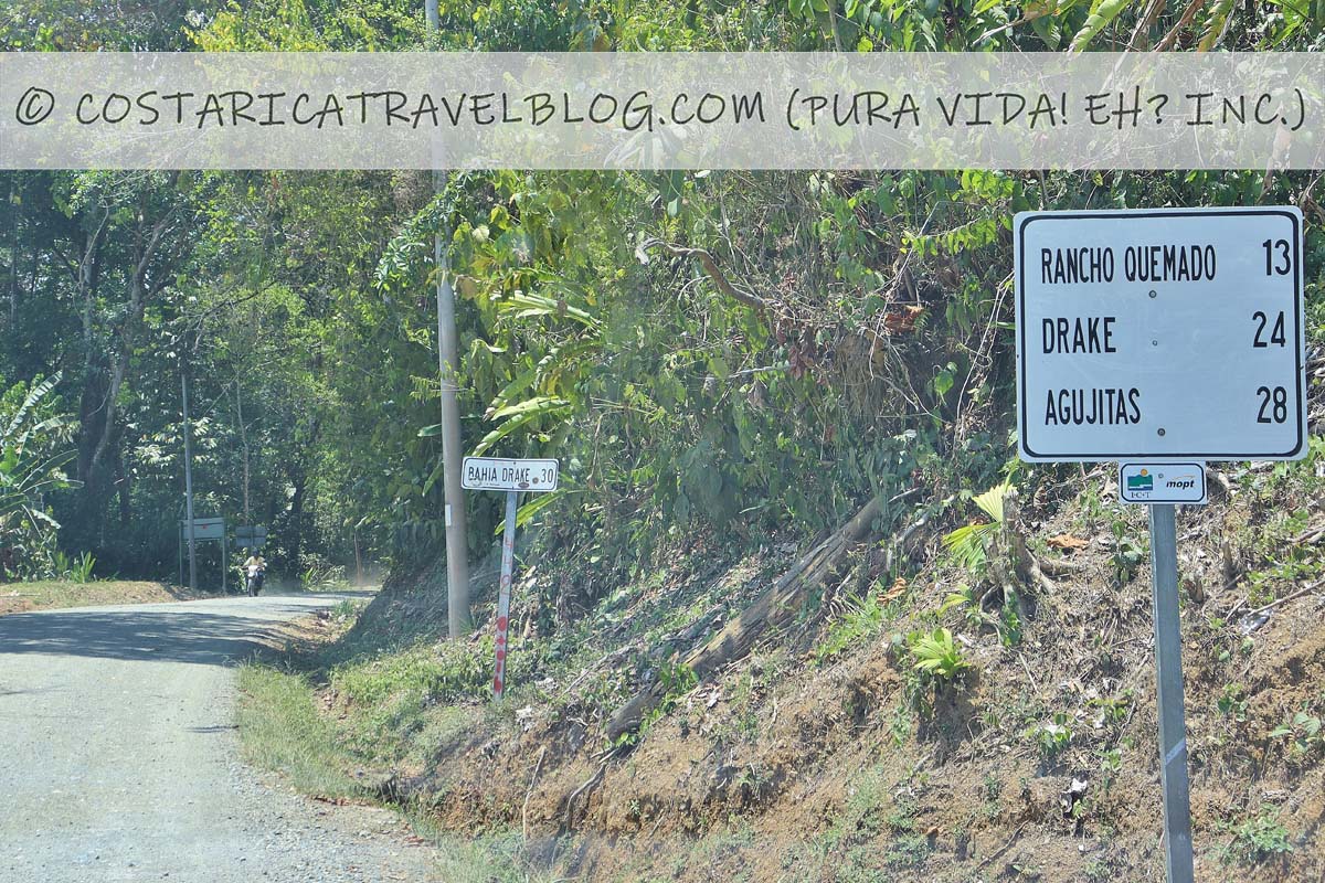
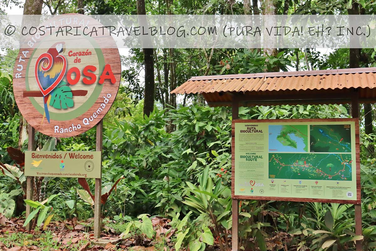
Rancho Quemado Rancho Quemado is a small community that sits roughly halfway between the turnoff at Rincon and the village of Agujitas. You’ll drive through Rancho Quemado on your way to and from Drake Bay.
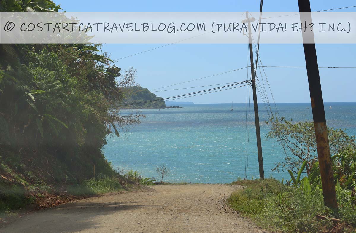
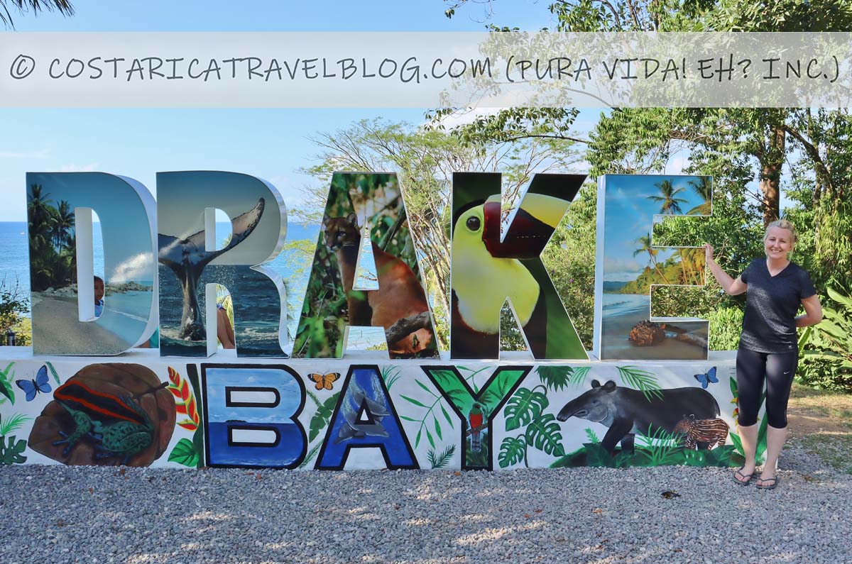
Agujitas Agujitas is the name of the village at Drake Bay. Though the destination is colloquially referred to as “Drake Bay” (named after the area’s sparkling bay), the name of the community is “Agujitas.” Agujitas is approximately 30 kilometers west of the turnoff near Rincon.
The most popular driving route to Drake Bay
Though a road connects the communities of Agujitas (Drake Bay center) and Sierpe (where boats to Drake Bay are commonly caught), this back-road route isn’t the most common way to reach Drake Bay by car. Instead, visitors typically arrive at Drake Bay via this main route:
The route from the northeast (Road 245 and the unnamed road that passes through Rancho Quemado) via Chacarita and Rincon You’ll likely take this route if you’re driving to Drake Bay from anywhere in Costa Rica, with the exception of a handful of destinations that sit south of Rincon, including Puerto Jimenez and Cabo Matapalo. (In these cases, you’ll travel to Drake Bay from the southeast, but you’ll still travel Road 245 and the unnamed road that passes through Rancho Quemado along the way.)
Continue reading below for more specific information about each road, including alternative road names; destinations encountered along the road; road conditions, design, and terrain; traffic pace and flow; whether the road has tolls or requires river crossings; whether you need a 4×4 vehicle to travel the road; and special driving-related notes and advisories.
Driving to Drake Bay: The roads
Road 245
Road 245Road 245Road 245Road 245
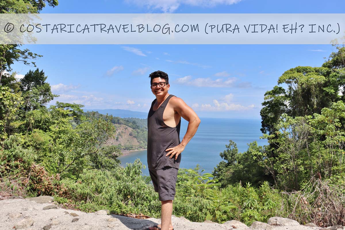
Road 245 is best known for being the road that connects Chacarita (Highway 2) with Puerto Jimenez. This road first runs east-west then veers north-south as it travels around the Golfo Dulce. When driving to Drake Bay, you’ll travel the first half of Road 245 from Chacarita before turning right (just after Rincon) onto the unnamed road that passes through Rancho Quemado. This drive (from Chacarita to the turnoff just after Rincon) is about 45 kilometers and takes roughly 45 minutes, or longer if rain requires you to drive the curvy road at a slower pace.
Alternative road names: The road to Puerto Jimenez
Popular destinations encountered along the route: Puerto Jimenez; roadside lookout spots that showcase unobstructed views of the Golfo Dulce
Off-the-beaten-path destinations encountered along the route: Cabo Matapalo, Carate (gateway to the La Leona Sector of the Corcovado National Park)
Destinations reached by cutoffs along the route: Dos Brazos (gateway to the El Tigre Sector of the Corcovado National Park)
Road conditions and design: paved, single-lane road
Terrain: hilly; curvy in places, especially between Chacarita and Rincon
Pace: moderate; slower around curves
Traffic: mild
Flow: two-way road
Tolls: none
River crossings: none
4×4 vehicle required: no
Special notes and advisories: Take curves slowly, especially when driving after dark or in the rain; enjoy views of the Golfo Dulce to the south of Road 245 while driving between Chacarita and Rincon
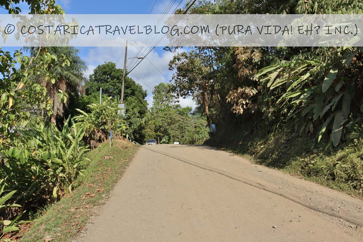
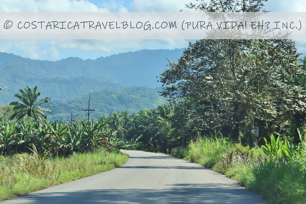
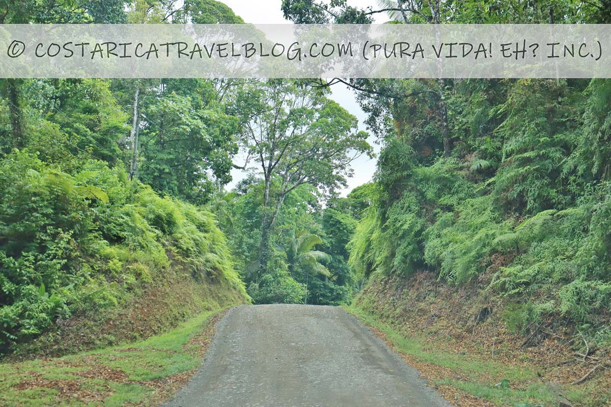
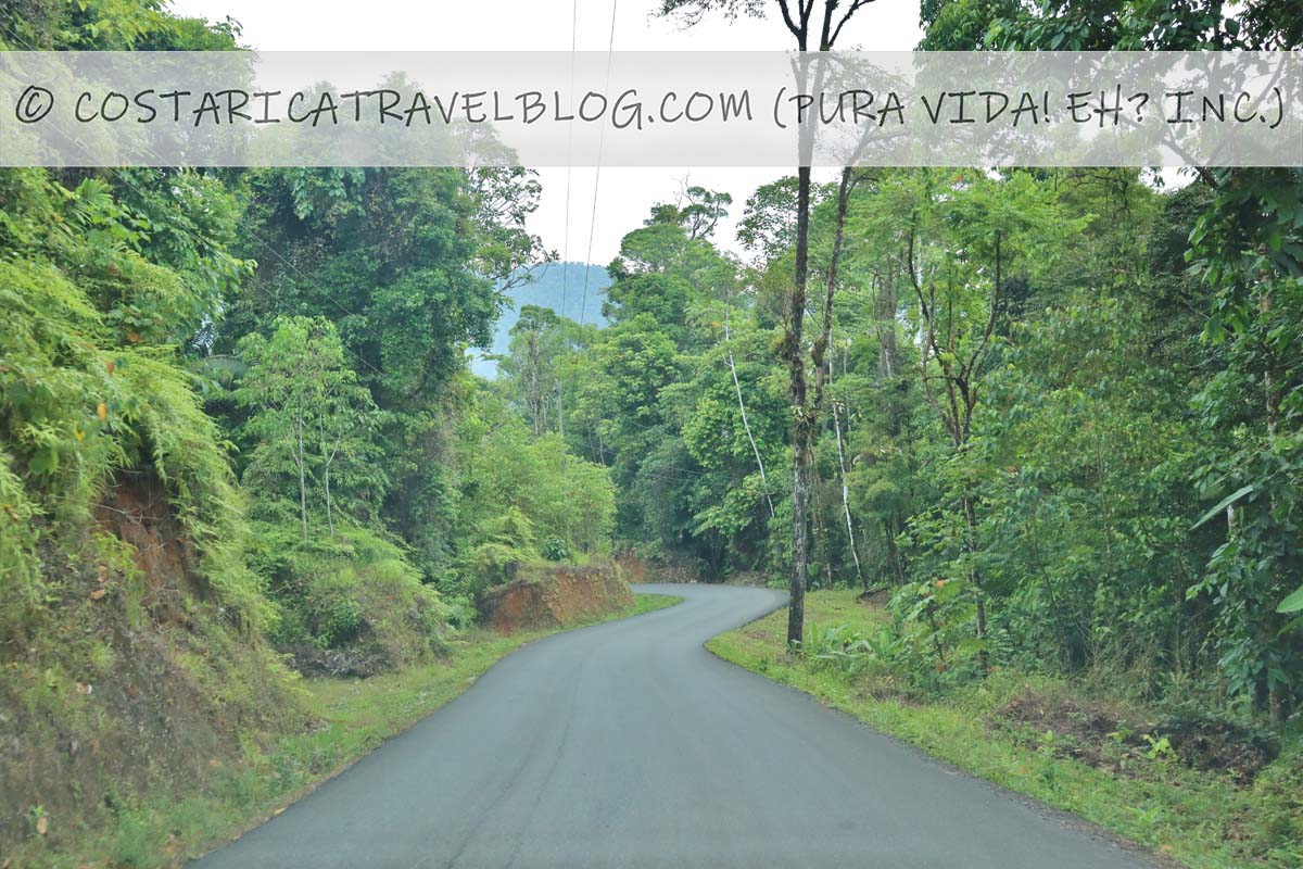
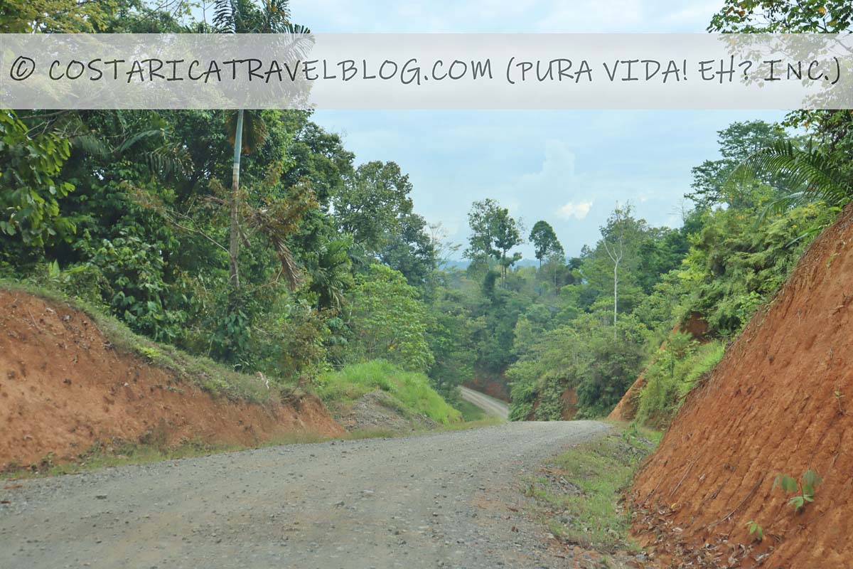
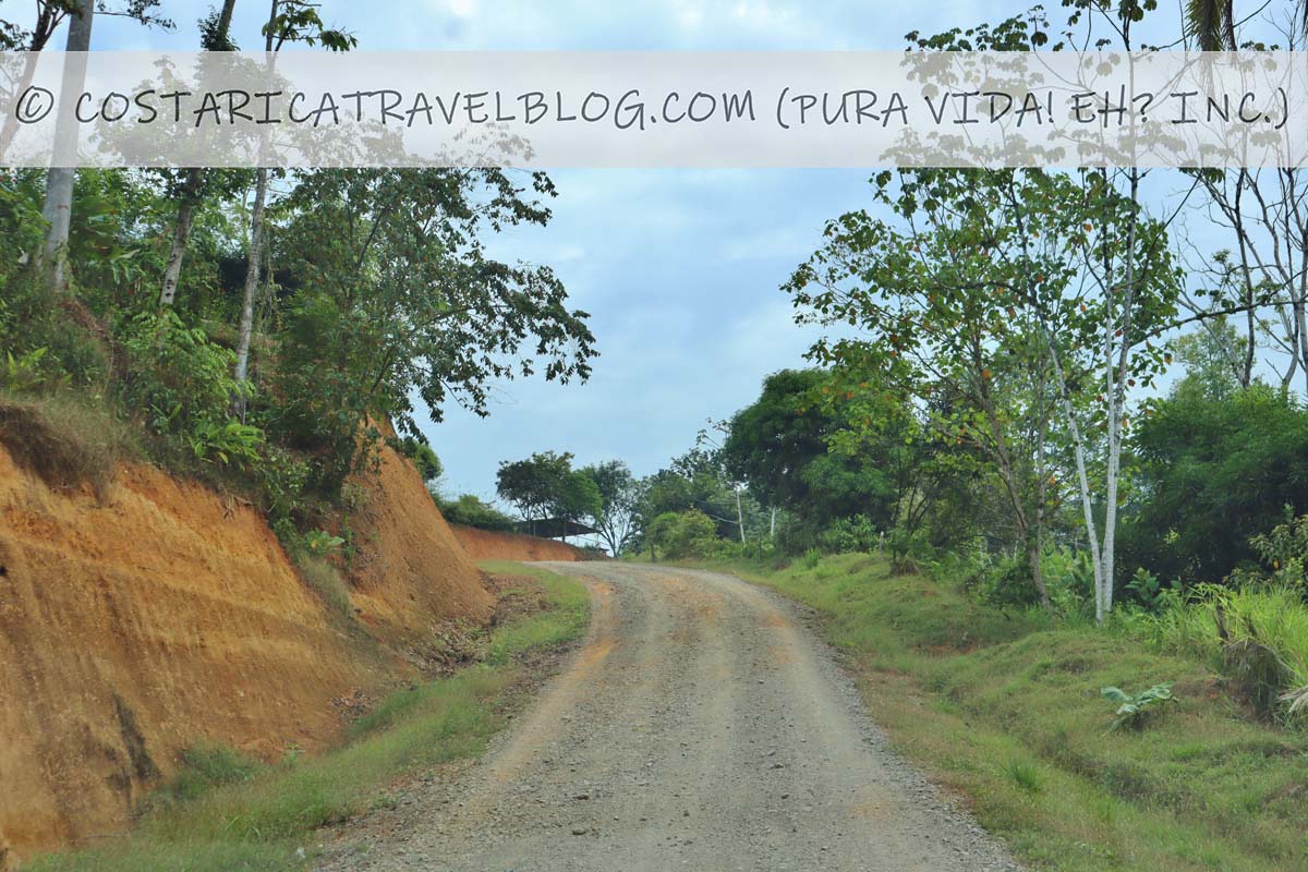
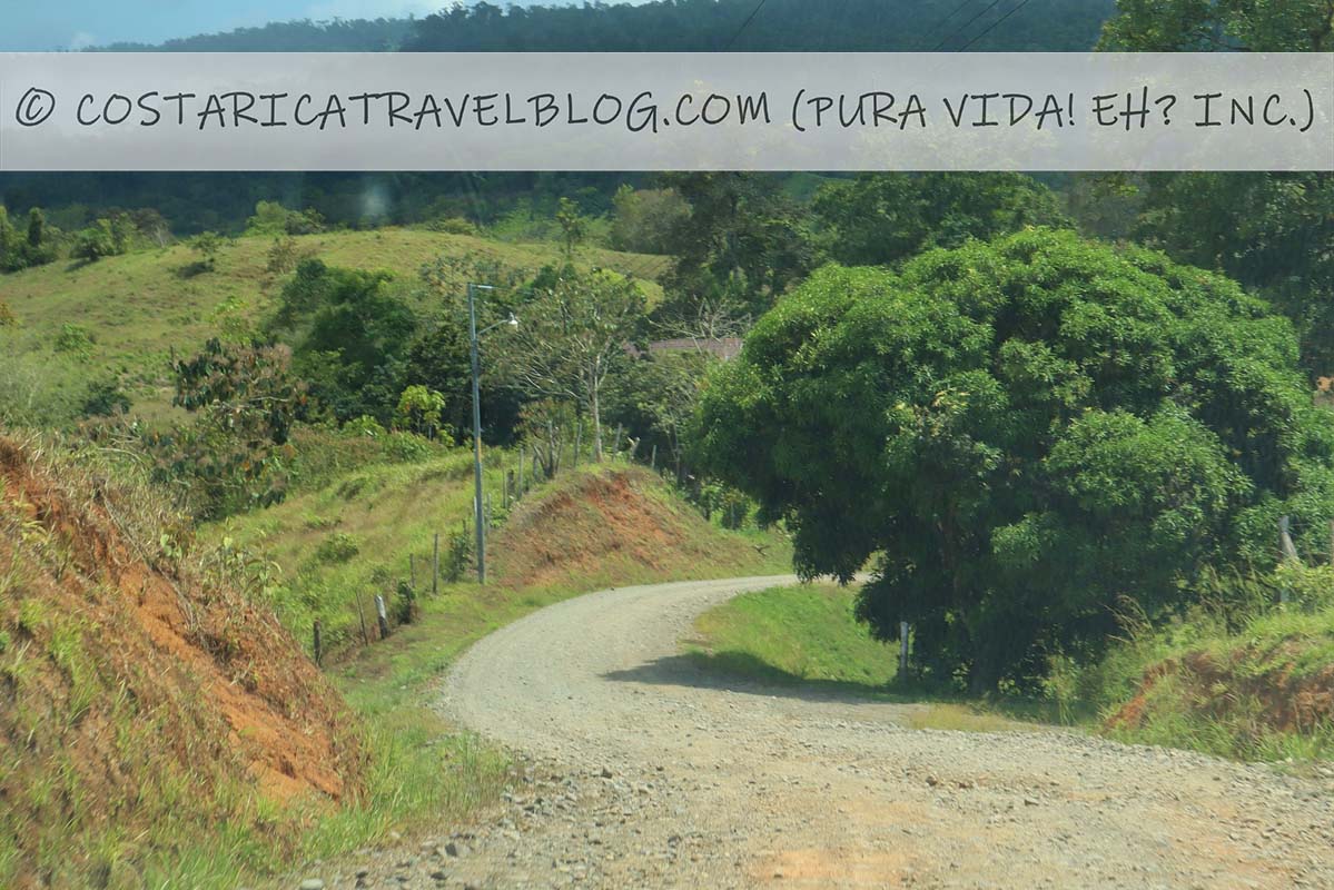
The unnamed road that passes through Rancho Quemado
Driving from Rincon to Rancho Quemado
the road through Rancho Quemadothe road through Rancho Quemadothe road through Rancho Quemadothe road through Rancho Quemadothe road through Rancho Quemadothe road through Rancho Quemadothe road through Rancho Quemadothe road through Rancho Quemadothe road through Rancho Quemado
Driving from Rancho Quemado to Drake Bay / Agujitas
the road through Rancho Quemadothe road through Rancho Quemadothe road through Rancho Quemadothe road through Rancho Quemadothe road through Rancho Quemadothe road through Rancho Quemadothe road through Rancho Quemadothe road through Rancho Quemadothe road through Rancho Quemadothe road through Rancho Quemadothe road through Rancho Quemado
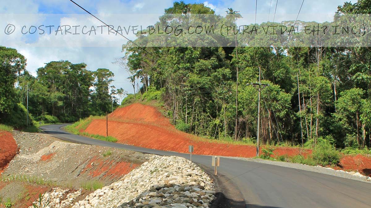
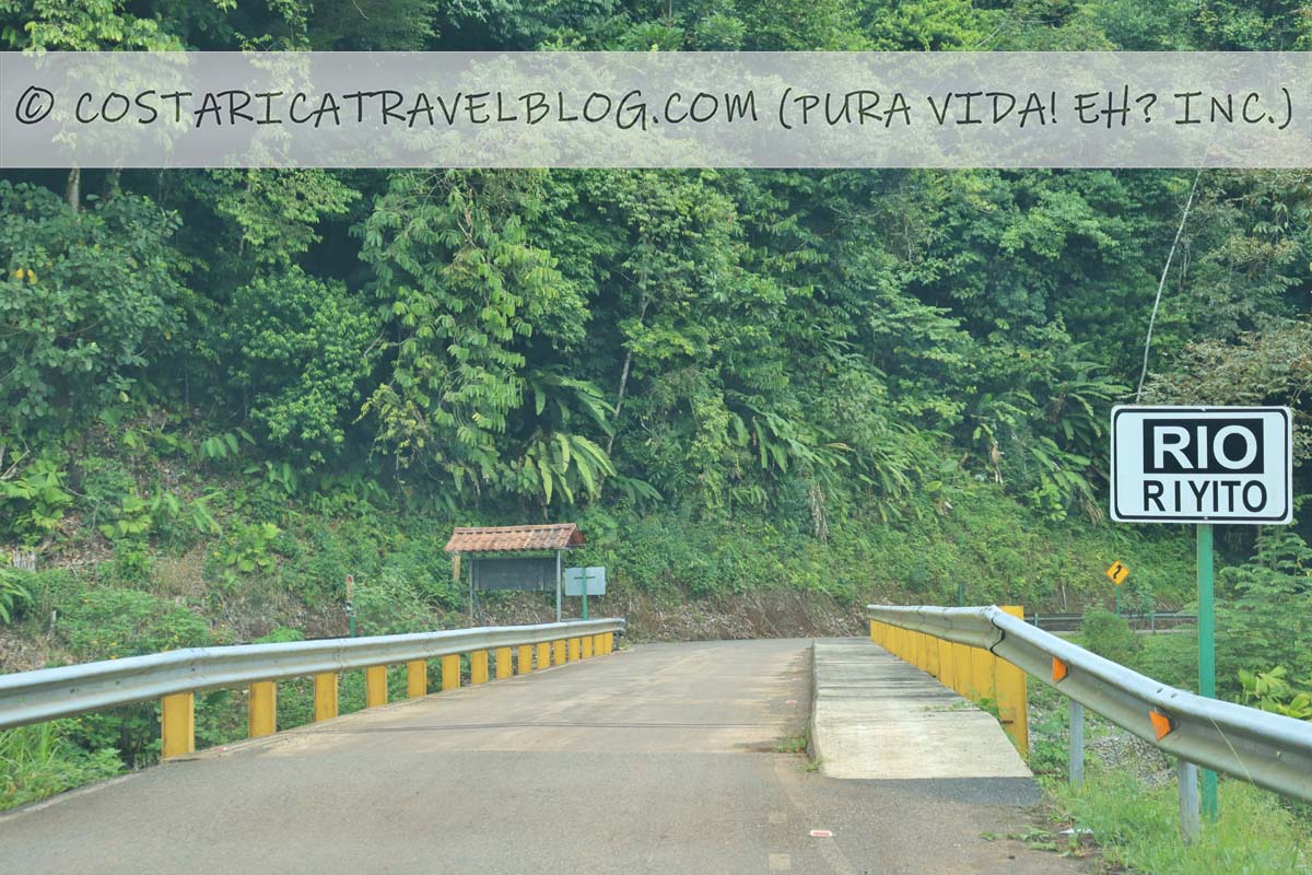
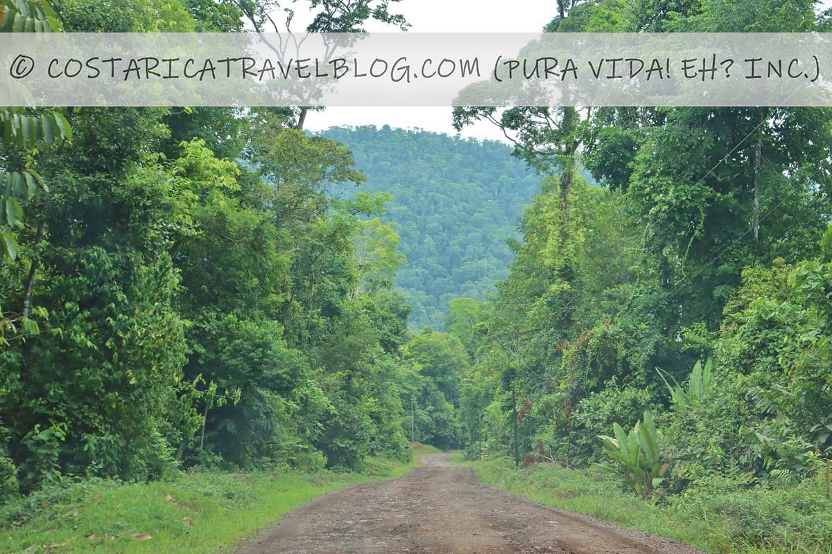
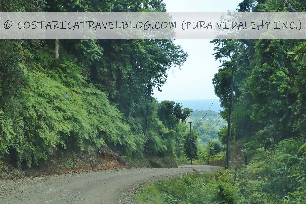
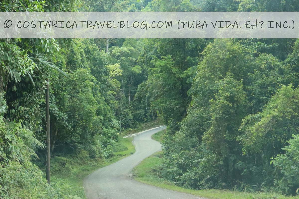
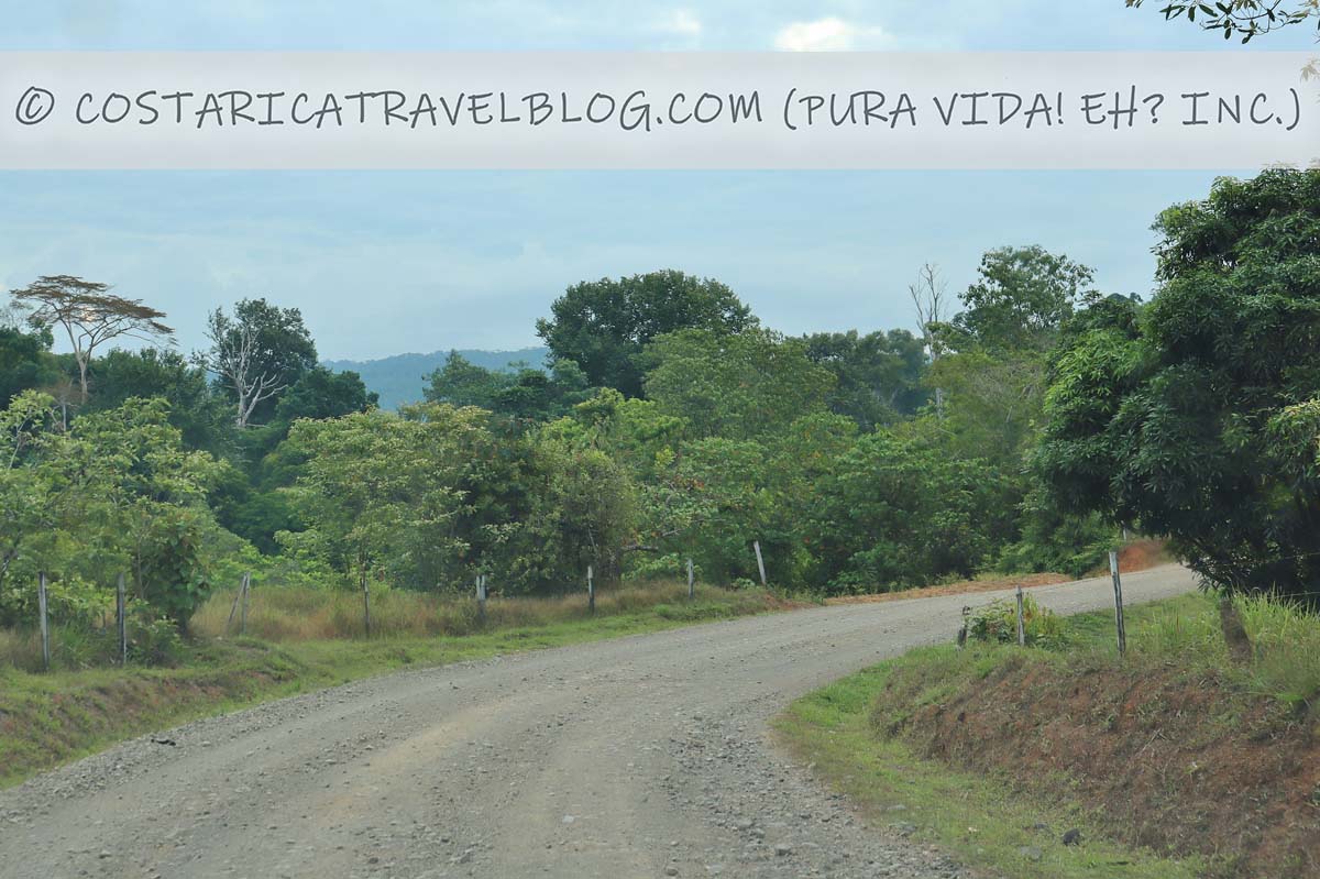
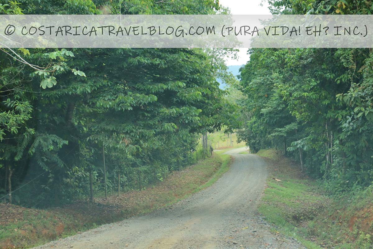
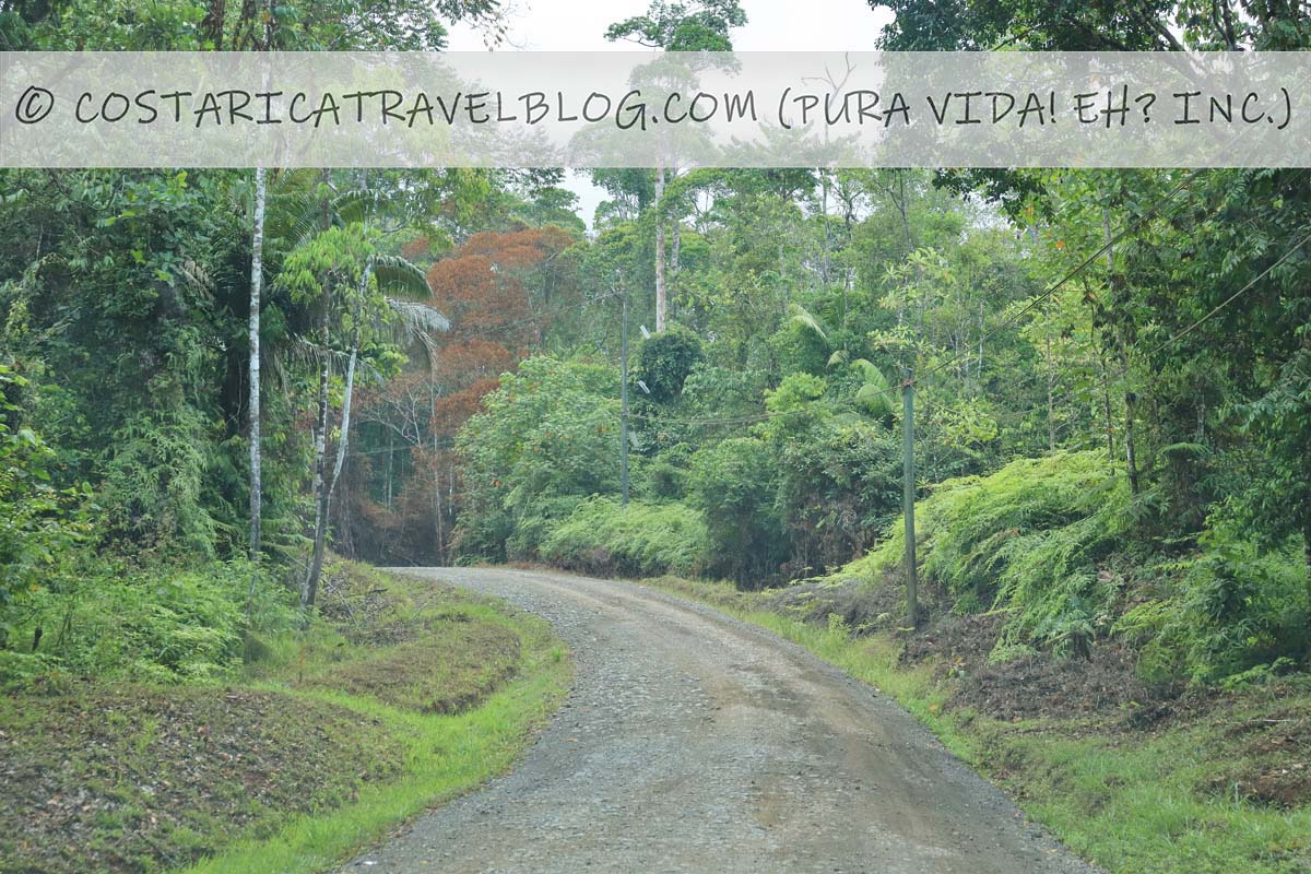
The unnamed road that passes through Rancho Quemado provides a nearly direct passage from Road 245 (just south of Rincon) to the village of Agujitas. The road runs east-west and cuts across the Osa Peninsula, cruising through Rancho Quemado along the way.
When driving to Drake Bay, you’ll travel this winding but direct road in its entirety, but as it approaches Agujitas (about 7 kilometers before the village), you’ll need to stay left when the road forks. (The route to the right, which has river crossings, leads to the airport; see below for details.) This drive (from the turnoff just after Rincon to Agujitas) is about 30 kilometers and takes roughly 1 hour when the road is dry. During wet periods, when the road is slippery, the drive can easily take twice as long.
Alternative road names: The road to Rancho Quemado; the road to Drake Bay
Popular destinations encountered along the route: Drake Bay
Off-the-beaten-path destinations encountered along the route: Rancho Quemado
Destinations reached by cutoffs along the route: N/A
Road conditions and design: single-lane, oftentimes narrow road that’s paved in places, comprised of pressed gravel in places, and a dusty dirt road in places
Terrain: hilly; curvy in places
Pace: moderate when dry; slow (especially in places with inclines or declines) when wet
Traffic: mild; few visitors travel to Drake Bay by car, so the road receives little traffic
Flow: two-way road
Tolls: none
River crossings: none if you keep left at the fork in the road roughly 7 kilometers before Agujitas (the route to the right can have river crossings)
4×4 vehicle required: yes
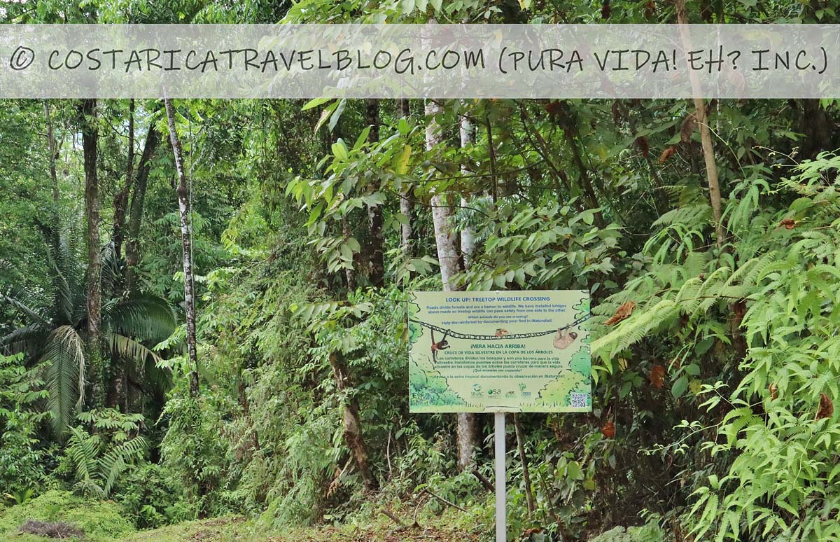
Special notes and advisories: Take curves slowly, especially when driving after dark; be mindful of wildlife crossing the road
Driving to Drake Bay: Important considerations
River crossings (and how to avoid them)
Until recently, it was impossible to drive to Drake Bay without crossing at least one river. Though other (outdated) resources suggest that it isn’t a good idea to drive to Drake Bay, in contrast, we’re happy to recommend the trip because river crossings are no longer required, assuming you follow our recommended route when you approach Agujitas.
Our recommended route
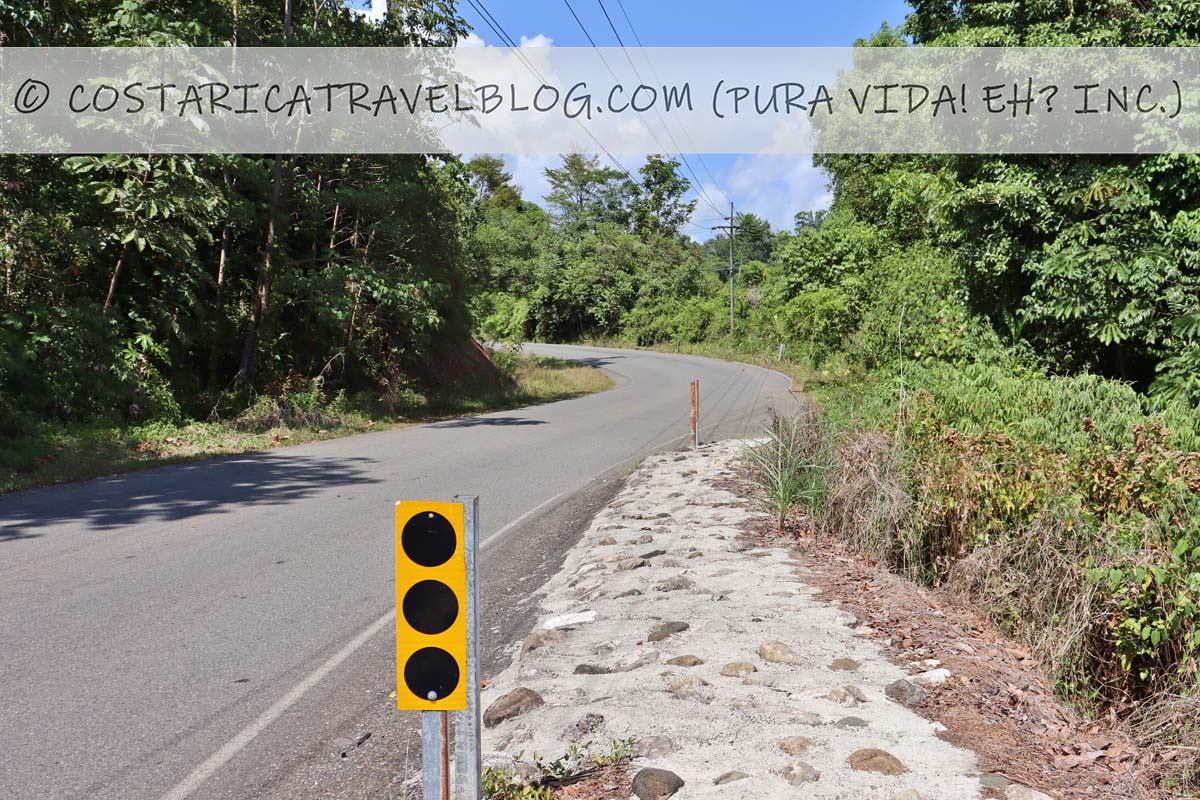
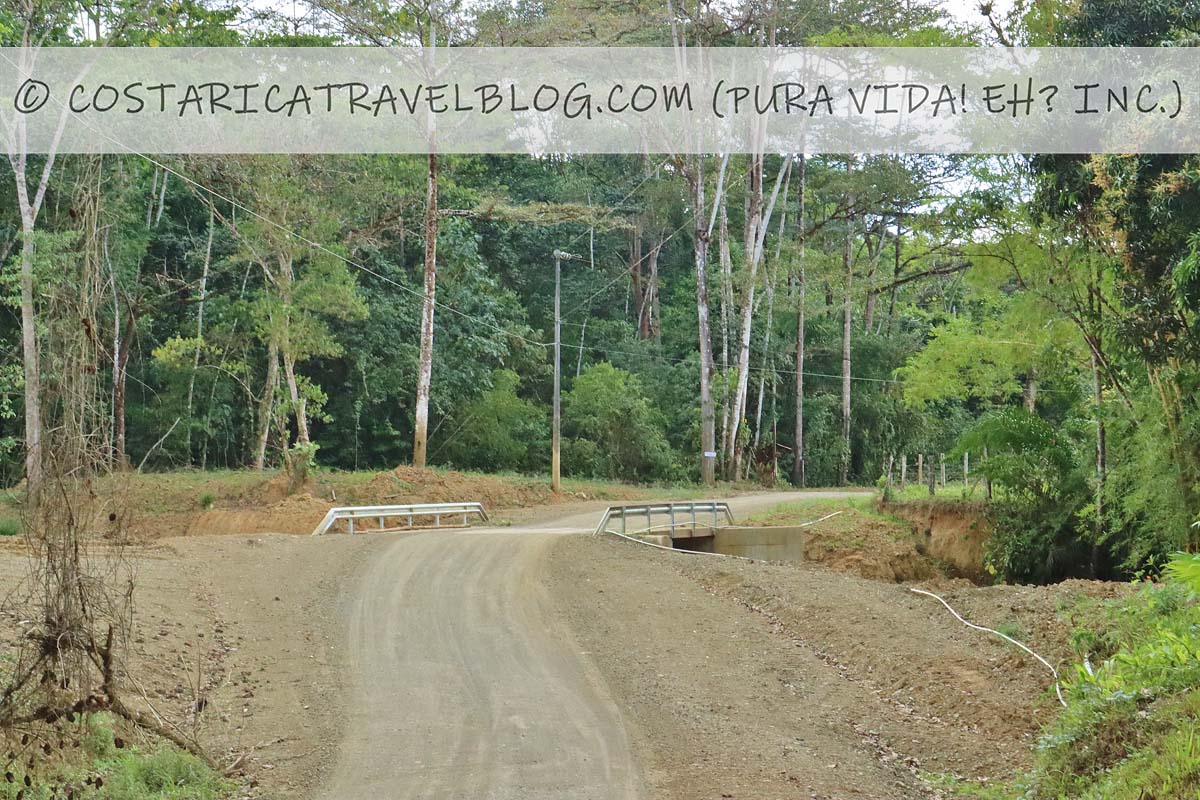
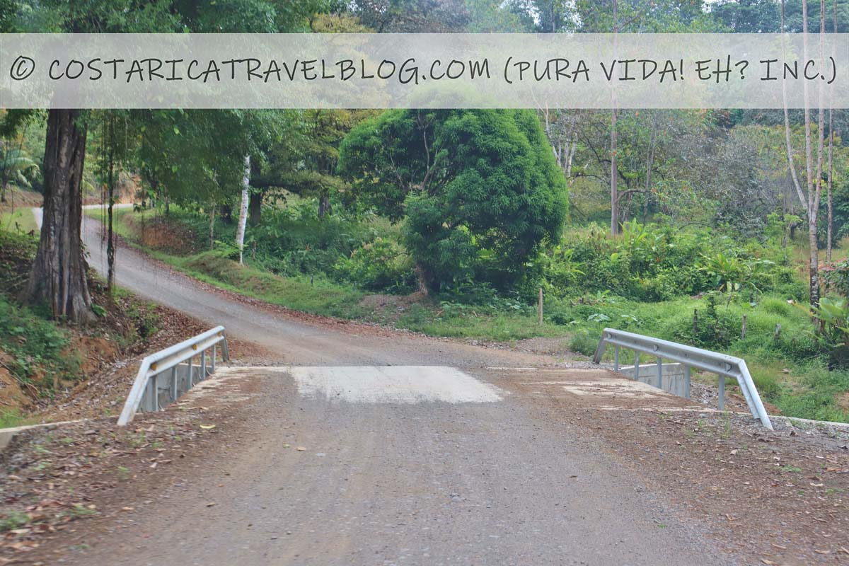
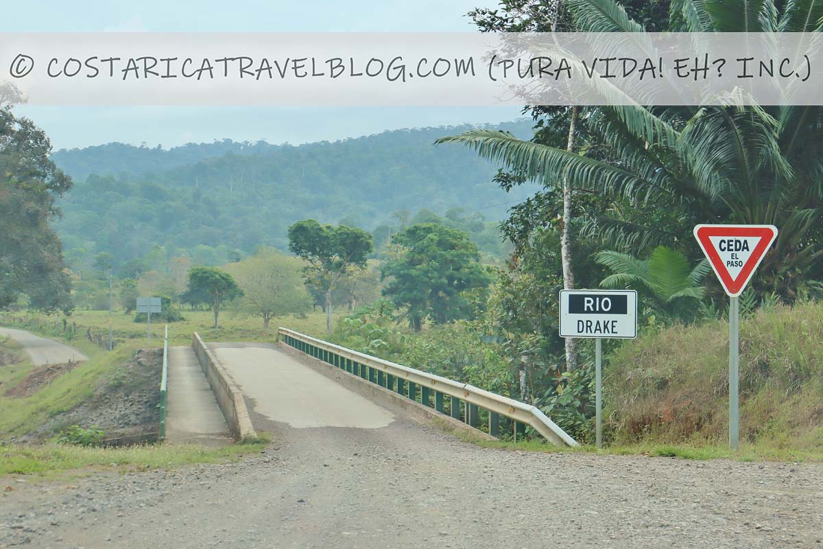
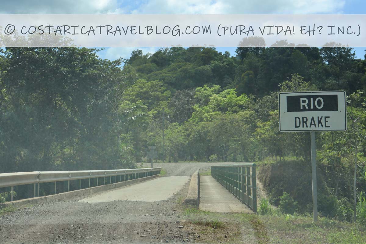
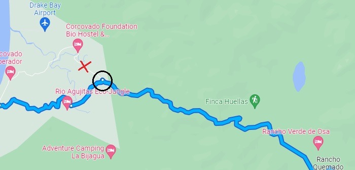
Avoiding Drake Bay’s few remaining river crossings is easy. Simply take the route to the left when the road (the unnamed road that passes through Rancho Quemado) forks roughly 7 kilometers before Agujitas. The photo below shows the fork in the road; the black circle on the map below shows where you need to keep left (as opposed to keeping right/straight) during the drive.
the fork in the road 7 kms before Agujitas; take the route to the left (not pictured) to avoid river crossings encountered along the route to the right (pictured above as straight)
The road to the left leads to the new bridge over Rio Drake, a large river that was oftentimes impassable prior to the construction of the bridge. This route encounters no river crossings. The road to the right, which leads to the Drake Bay airport and a few other establishments, has river crossings. Note that Google Maps automatically sends drivers to the route to the right (the route marked with a red “X” on the map below) so you’ll need to physically select the leftward route in order for Goggle Maps to follow it.
Coming from the southeast at Rancho Quemado, the map shows where you should keep left to avoid river crossings
Gas and car maintenance
There are no gas stations in Drake Bay / Agujitas. The largest gas station in the vicinity is in Chacarita (on the corner of Highway 2 and Road 245), which is a 75-kilometer drive from Agujitas, so make sure you fill up on gas in Chacarita. (If you plan to drive to Drake Bay from Puerto Jimenez/the south, fill up on gas before leaving Puerto Jimenez.) It’s also a good idea to stop at the gas station to make sure your rental car is in good working condition before heading out to remote Drake Bay. (Civilization is practically non-existent between Chacarita and Agujitas, with the exception of residents of Rancho Quemado.) Make sure your windshield wipers work well, and that all four tires are full of air and leak-free. If you need to buy food, drinks, or snacks; withdraw money from an ATM (Drake Bay doesn’t have a bank or ATM); or use the bathroom, the gas station in Chacarita is the best place to handle these matters.
Rain
The most common hazard you may encounter during the drive to Drake Bay is rain. Rain can make paved and dirt roads extra slippery, and can make it easier for your vehicle to slide out on pressed-gravel roads where loose gravel bits are present. If you drive slow, though, especially on downhill sections and around curves, you should be fine.
It helps to know that unlike several other driving routes in Costa Rica (e.g., Cerro de la Muerte, some roads to Monteverde, the road to San Gerardo de Dota, and roads around Vera Blanca), the unnamed road that passes through Rancho Quemado cuts through mountains, it doesn’t skirt around them. This means that you won’t travel beside steep cliffs along the route (you’ll pass by some when driving the paved Road 245, though), which is a stress-reducing advantage you’ll quickly appreciate if you need to make the drive during a downpour.
It goes without saying that rainfall amounts are higher in the Drake Bay area during Costa Rica’s wet/green/rain season. (For more information about Costa Rica’s seasons, don’t miss our related blog post: When To Go To Costa Rica According To Cost, Weather, Wildlife, And More!) You can reach Drake Bay by car at any time of the year, but give yourself double the amount of time (3.5 hours as opposed to 1 hour and 45 minutes) to complete the drive between Chacarita and Agujitas if you choose to visit during the wet/green/rain season. Regardless of when you travel, drive responsibly and cautiously along the entire route.
Driving to Drake Bay: Duration and Distance Chart
Planning to drive to Drake Bay from one of Costa Rica’s most popular destinations? Our chart below outlines the route, distance, and approximate duration for each trip to Drake Bay.
Do you have questions about visiting Drake Bay, want to know more about driving to Drake Bay (or alternatives ways to get to/from Drake Bay), or need help deciding if Drake Bay is worth visiting? No problem! When you’re ready, make an appointment here to communicate with me (Nikki) privately and we can discuss these and other topics to get your questions answered fast and your Costa Rica trip poised for success. Pura vida, amigos! 🙂
Hey, Costa Rica Travel Blog reader, thank you for visiting and reading our blog! We're truly grateful for your time and preference.
Do you know that your spam-free reading experience is most important to us? Unlike some other Costa Rica blogs, we do not to sell your personal information, and we choose not to display ads, sponsored content, or affiliate marketing on our blog so we can keep your visit as distraction- and junk-free as possible. Because we prioritize your privacy, we don't earn money when you visit us, when you sign up for our e-course, or when you click on our links, which means the time and work we put into this blog—including its 300+ articles—is entirely voluntary! If you find our content valuable, and you'd like to thank us for making the trip-planning process easier and your Costa Rica vacation more enjoyable, please consider making a small donation ($1, $2, $3, or an amount of your choosing) to our blog. Doing so is a great way to pat us on the back if you feel we deserve it. 😊 Pura vida, amigos!
Click on the button above to donate through PayPal. (If you cannot see the PayPal button above, click here.) A PayPal account is not required to make a donation; credit and debit cards are also accepted. PayPal donations are confidential; we never see your payment details.
Love our blog? Check out our other Costa Rica-related projects, too:
Summary
Article Name
Driving to Drake Bay: Photos, Road Conditions, Routes, Drive Times, And More!
Description
Everything you need to know about driving to Drake Bay: possible routes, road descriptions, a distance/duration chart, and more!
The comment section of this article has moved! If you have a question or comment about our article above or Costa Rica travel in general, please post it in our Questions and Answers Forum on DIY Costa Rica, our sister website, where you can also access our private Costa Rica recommendations, our Costa Rica Destination Tool, and our Costa Rica Recommendations Map. See you there, amigos! 🙂
Author
Posts
Viewing 1 reply thread
The forum ‘Costa Rica Travel Blog Forum’ is closed to new topics and replies.
The LATEST: Prefer learning by listening, not reading? We're now on Spotify! Listen here. The GREATEST: Humbly, this is the best Costa Rica blog. Discover why here. Pura vida, amigos!


Tagged: drake bay, driving in costa rica