FOR YOU, FOR FREE: 19 years' worth of firsthand Costa Rica trip planning and travel advice compiled into hundreds of articles, plus exclusive discounts.
Driving to Monteverde: Photos, Road Conditions, Routes, Drive Times, And More!
Article last updated on May 28, 2025. Note that an old date may indicate that an update is not required, not that the text is outdated.
Everything you need to know about driving to Monteverde
We’ve traveled around Costa Rica multiple times over, but because we lived in La Fortuna for several years (since 2007), the neighboring destination of Monteverde is a place we’ve driven to more times than we can count. If you intend to drive to Monteverde—either from La Fortuna or elsewhere in the country—and you’d like to be prepared for the trip, you’ve come to the right place. Below, you’ll find a description of driving routes to Monteverde, as well as descriptions of the roads and highways you’ll encounter along the way.
The three most popular driving routes to Monteverde
Visitors typically arrive at Monteverde via one of three main routes:
The route from the southeast (Highway 1 and Road 606) via Sardinal and Guacimal You’ll take this route if you’re traveling to Monteverde from either San Jose, a destination along the central or southern Pacific coast (e.g., Jaco, Manuel Antonio, Dominical, Uvita, Drake Bay, or Puerto Jimenez), or a destination on the Caribbean coast (e.g., Tortuguero, Cahuita, or Puerto Viejo de Talamanca). You might take this route (or one of the other two routes described below) if you’re traveling to Monteverde from Liberia or a destination along the northern Pacific coast.
The route from the southwest (Highway 1, Road 145, and Road 606) via Las Juntas and Abangares This is a less popular alternative to the route from the southeast (described above). Though this route can also be taken from San Jose, a destination along the central or southern Pacific coast, or a destination on the Caribbean coast, most travelers opt to take the route from the southeast instead.
The route from the north (Road 142, Road 145, and Road 606) via Tilaran You’ll take this route if you’re traveling to Monteverde from La Fortuna or another destination in the northern inland region, such as Bijagua, Nuevo Arenal, or El Castillo. You might take this route (or one of the two routes described above) if you’re traveling to Monteverde from Liberia or a destination along the northern Pacific coast.
Driving to Monteverde: Route map
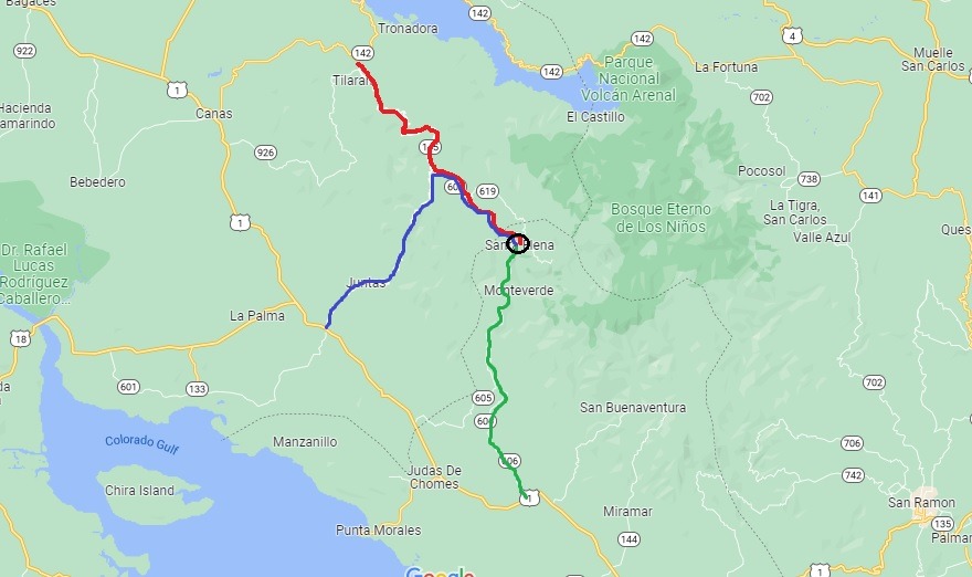
The below map is a visual representation of the three main routes to Monteverde.
The green route is the route from the southeast
The blue route is the route from the southwest
The red route is the route from the north
The black circle identifies Santa Elena (Monteverde center)
Which route to Monteverde is the best?
Here’s a chart to help you quickly identify some of the advantages and disadvantages of each main route to Monteverde:
Route
Conditions
The route from the southeast (Highway 1 and Road 606)
This paved route provides fewer cliffside drives and curves than the route from the southwest, but more cliffside drives and curves than the route from the north. It also provides beautiful valley views and leads the most direct path to Monteverde (it doesn’t require another turn once you turn off the highway). It is generally regarded as the best route to take to get to Monteverde unless you plan to visit the destination from the north.
The route from the southwest (Highway 1, Road 145, and Road 606)
This paved route provides the greatest number of cliffside drives and curves, but also beautiful valley views. Though driveable and safe when driven slowly, this route is considered the most dangerous of the three routes to Monteverde. It also requires a turn to stay on course, and the turn is sometimes missed. It’s a good idea to have a paper map or saved offline map when making the trip because the internet signal is often weak when approaching the turn and Monteverde.
The route from the north (Road 142, Road 145, and Road 606)
This route provides the roughest road conditions (the road is comprised of pressed gravel in some sections and is paved in others) but the fewest cliffside drives, as well as beautiful views of Arenal Lake (and the Arenal Volcano, if driving from La Fortuna). It requires a few turns to stay on course, so it’s a good idea to have a GPS when making the trip. (Internet signal is typically strong throughout the route.)
Continue reading below for more specific information about each road and highway, including alternative road/highway names; destinations encountered along the road/highway; road/highway conditions, design, and terrain; traffic pace and flow; whether the road/highway has tolls or requires river crossings; whether you need a 4×4 vehicle to travel the road/highway; and special driving-related notes and advisories.
The roads to Monteverde
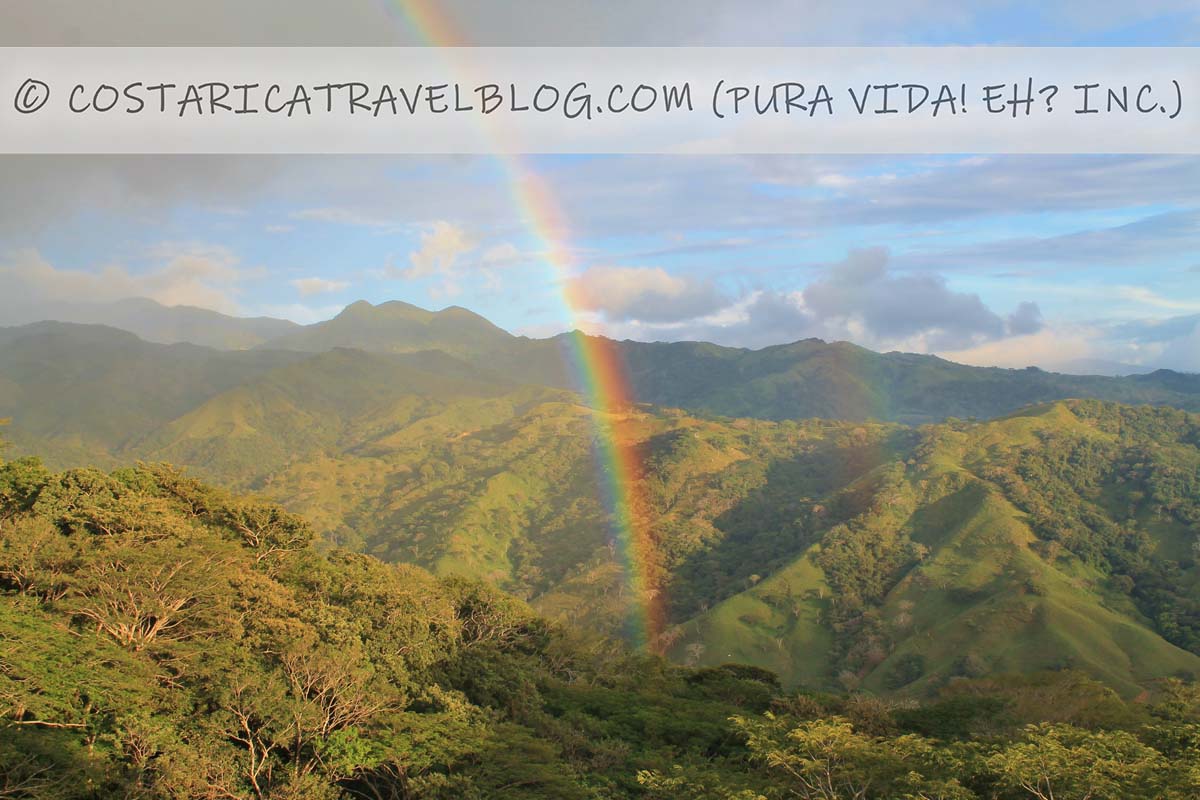
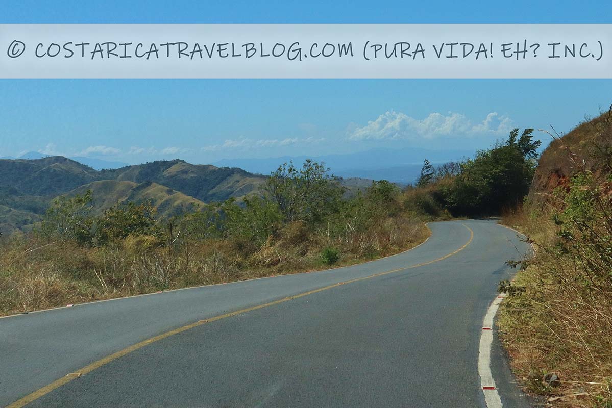
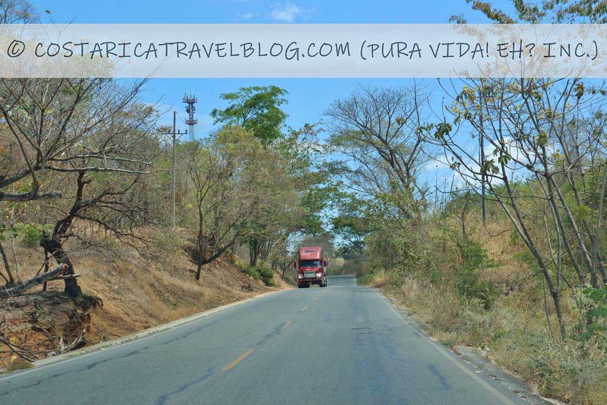
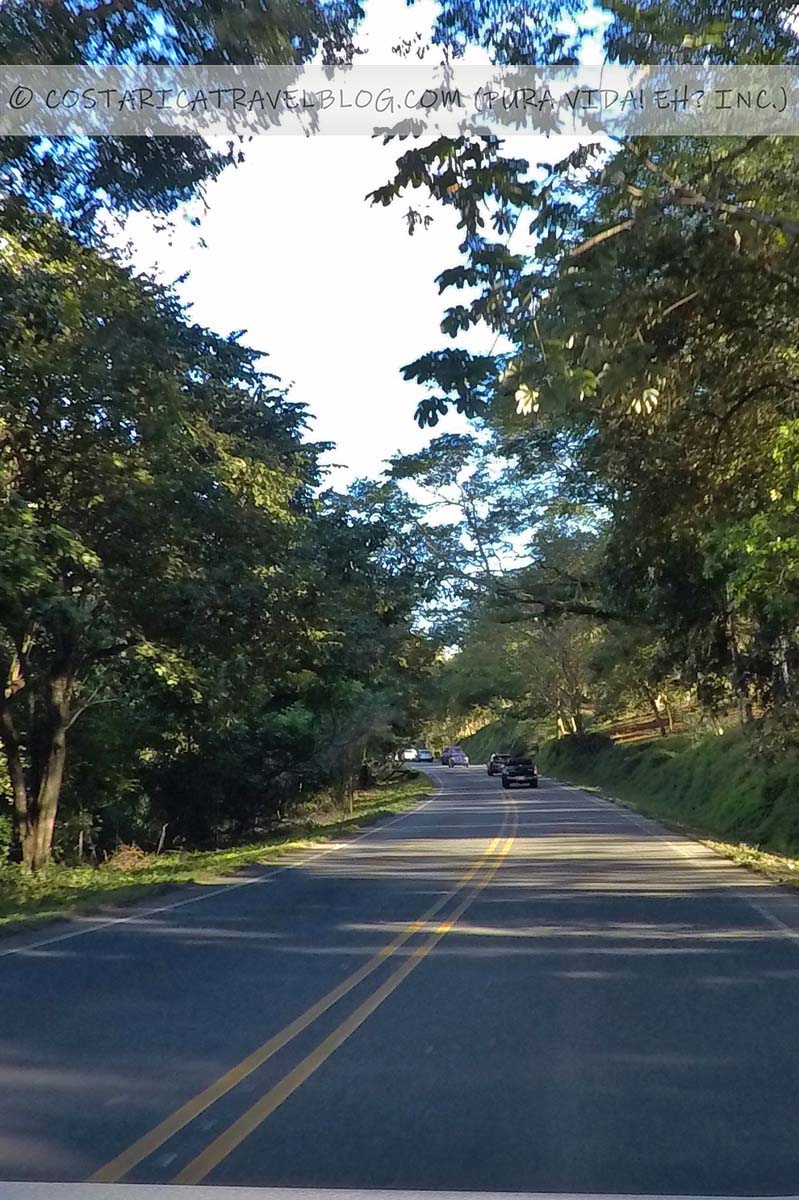
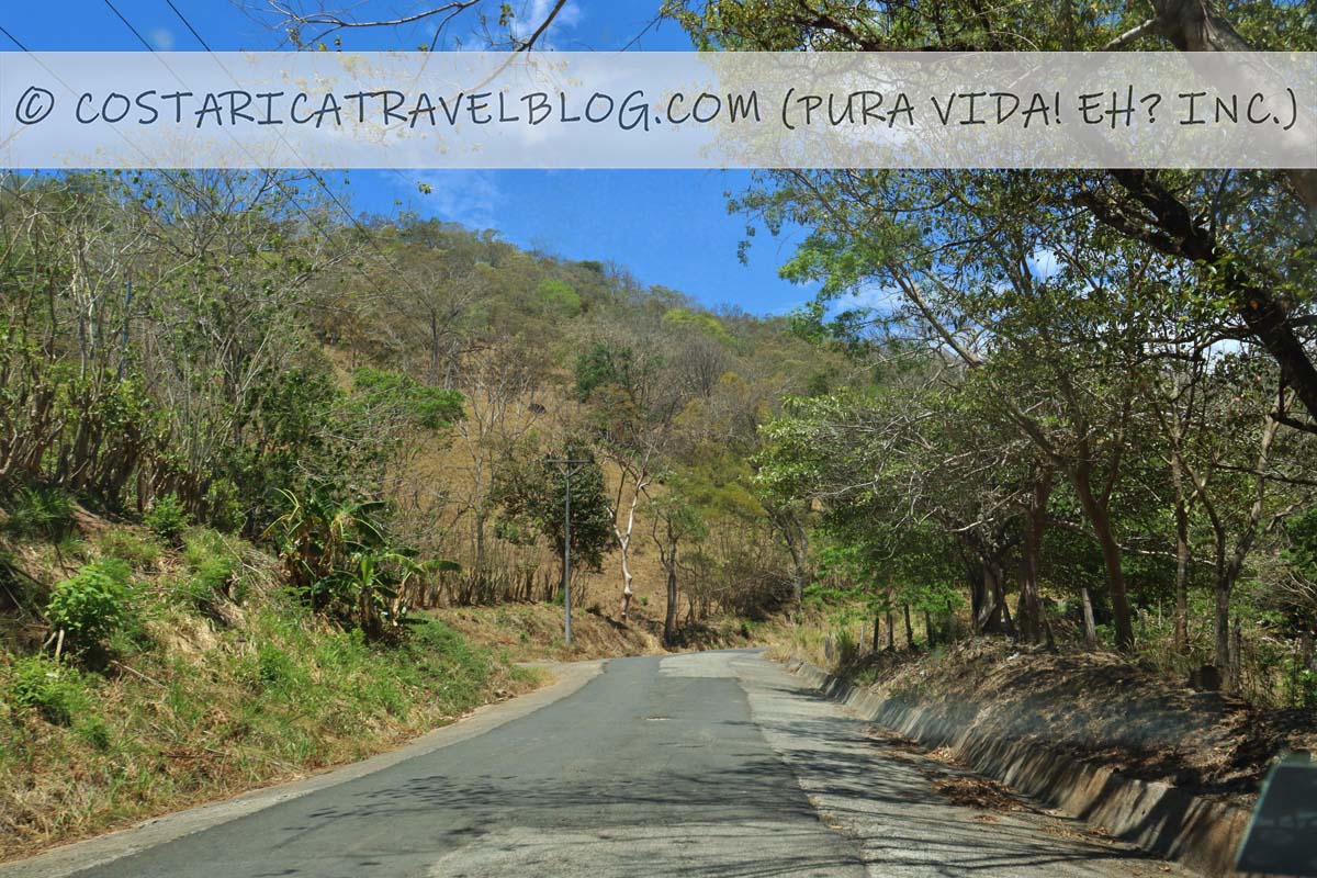
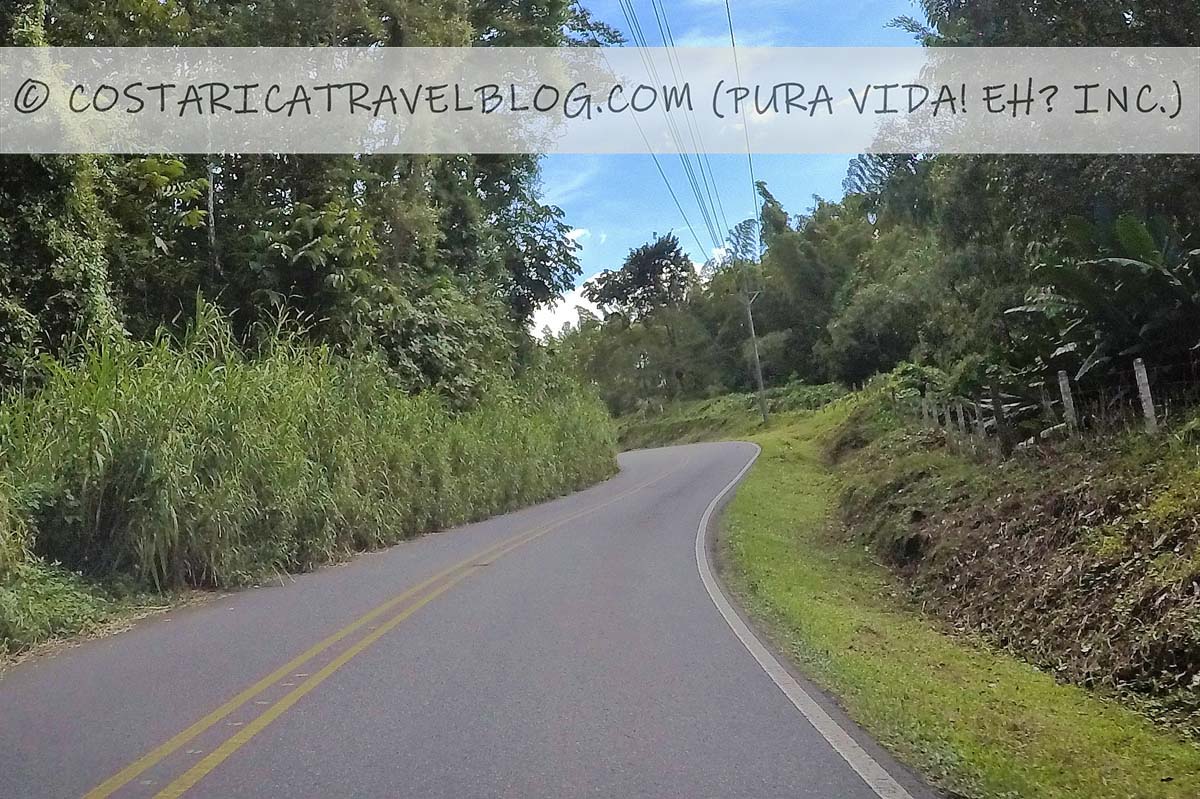
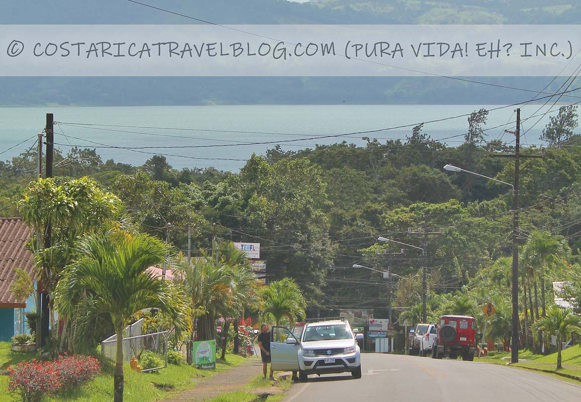
Road 606 (south of Monteverde)
Road 606 (south of Monteverde)Road 606 (south of Monteverde)Road 606 (south of Montevberde)Road 606 (south of Monteverde)Road 606 (south of Monteverde)view from Road 606 (south of Monteverde)view from Road 606 (south of Monteverde)
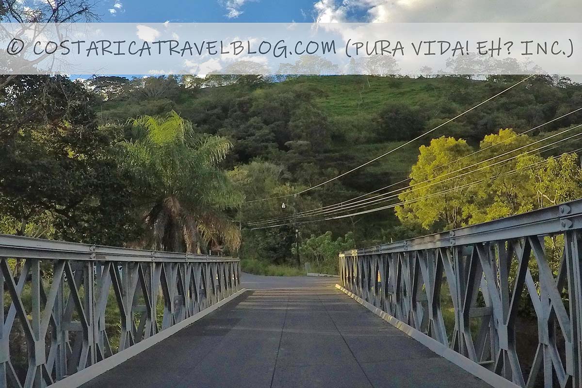
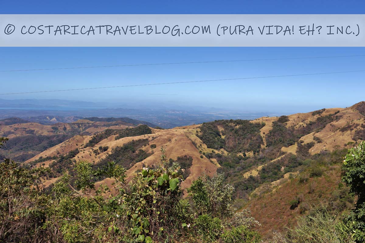
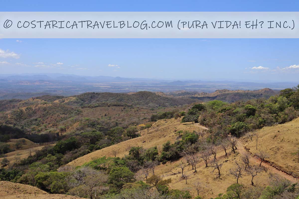
If you plan to enter Monteverde from the southeast, you’ll find Road 606 offers a beautiful, scenic drive over paved roads. Along the way you’ll see rolling hills, deep valleys, and, if you’re lucky, rainbows. Note that the route begins at Highway 1 and gradually climbs to Monteverde’s high elevation. The mountainous drive, which has sharp curves and nears cliffs in places, travels through cloud forest as it nears Monteverde. Though it’s a lovely journey to make during the day, driving slow is a must, especially in curvy areas or if it happens to be raining. Driving at night, when darkness and fog can make the route unsafe, is best avoided.
To reach Monteverde from the southeast, you’ll first travel on Highway 1 as far as the community of Sardinal, which is where the highway connects with Road 606 (there’s a gas station at the intersection). From the turnoff onto Road 606, it’s a 38-kilometer drive to Monteverde that takes roughly one hour.
Alternative road names: The road to Monteverde, the road to Guacimal
Popular destinations encountered along the route: Monteverde
Off-the-beaten-path destinations encountered along the route: N/A
Destinations reached by cutoffs along the route: N/A
Road conditions and design: paved, single-lane road
Terrain: mountainous and curvy in places, especially between Guacimal and Monteverde
Pace: moderate; slower around sharp curves or if you’re stuck driving behind a truck (passing in curvy areas is difficult and dangerous)
Traffic: moderate
Flow: two-way road
Tolls: none
River crossings: none
4×4 vehicle required: no
Special notes and advisories: This route travels through cloud forest so it’s best to avoid driving it after dark; take curves slowly and only pass vehicles (if necessary) on straightaways
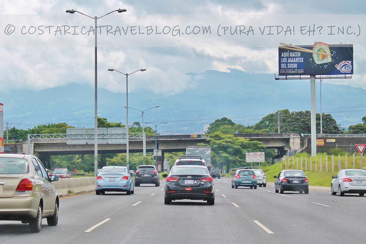
Highway 1
The information provided below about Highway 1 is an excerpt that only reflects sections of the highway that you may travel to/from Monteverde, depending on the route you take. For complete coverage of Highway 1 in Costa Rica, please see our related blog post:
Highway 1; between San Jose and AlajuelaHighway 1; between the turnoffs at Abangares and SardinalHighway 1; bus trafficHighway 1; between Liberia and Canastollbooth on Highway 1Highway 1; near Limonal
Highway 1 is Costa Rica’s most popular highway. It connects the west end of the centrally located capital city (San Jose) with the northwest corner of the country. It’s also considered an extension of Highway 2.
If you plan to drive to Monteverde from Liberia or a destination on the northern Pacific coast: You can take either the route from the southeast or the route from the southwest. Both routes will take you down Highway 1, but the route from the southeast will require an extra 30 minutes of highway driving. Though longer in duration and distance, the route from the southeast avoids the extra curves and cliffs you’ll encounter along the route from the southwest.
If you plan to drive to Monteverde from San Jose, a destination on the central or southern Pacific coast, or a destination on the Caribbean coast: It’s best to take the route from the southeast, not only to minimize the number of curves and cliffs you’ll encounter but also the amount of time you’ll spend driving on Highway 1.
Regardless of which route you take, the flat, smooth, fast-paced Highway 1 makes part of the drive to Monteverde a relatively easy and enjoyable one.
Alternative highway names: Carretera Interamericana; Inter-American Highway; Pan-American Highway; Autopista General Canas (east of Alajuela); Autopista Bernardo Soto (west of Alajuela); Carretera Esparza-Puntarenas (west of Esparza to Highway 17)
Popular destinations encountered along the route: San Jose and Liberia
Off-the-beaten-path destinations encountered along the route: Canas, Bagaces, and the border community of Penas Blancas
Destinations reached by cutoffs along the route: Monteverde, Puntarenas, beach towns on the Nicoya Peninsula, Bijagua, beach towns along the northern Pacific coast, the Rincon de la Vieja National Park, the Santa Rosa National Park, and Bahia Salinas
Highway conditions and design: paved, multi-lane (2-3 lane) highway in some areas and paved, single-lane highway in others
Terrain: primarily flat and straight
Pace: fast
Traffic: heavy at times; the highway is commonly shared with transport trucks and buses
Flow: two-way highway
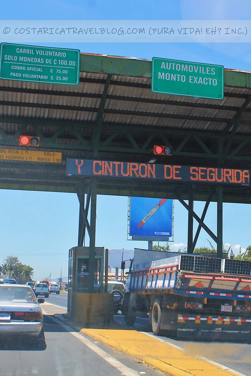
Tolls: yes; the highway has two tollbooths, one between Alajuela and San Jose and one between Alajuela and San Ramon
River crossings: none
4×4 vehicle required: no
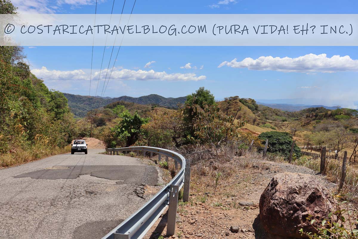
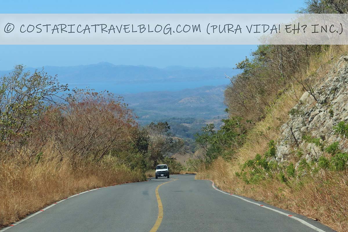
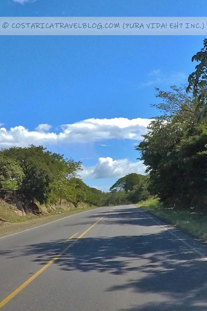
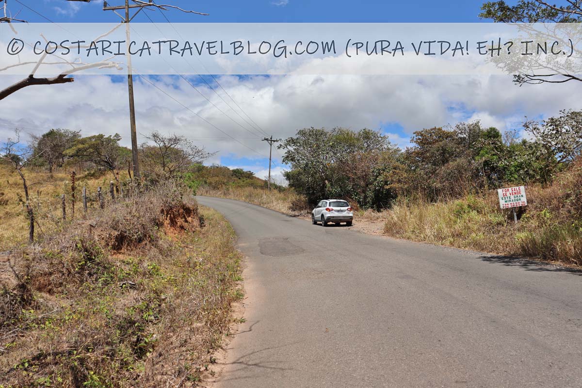
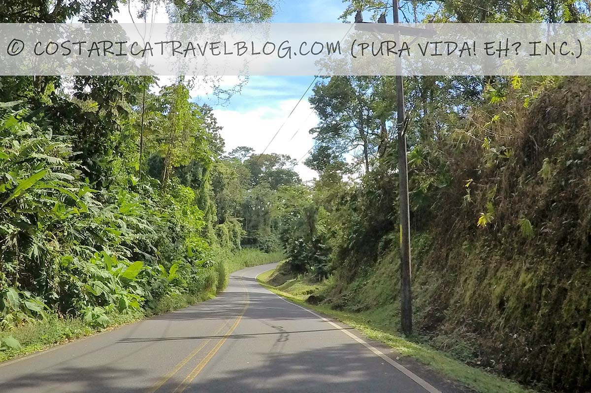
Road 145 (southwest of Monteverde)
Road 145 (southwest of Monteverde)Road 145 (southwest of Monteverde)Road 145 (southwest of Monteverde)Road 145 (southwest of Monteverde)Road 145 (southwest of Monteverde)Road 145 (southwest of Monteverde)view from Road 145 (southwest of Monteverde)
Like the route that travels to Monteverde from the southeast, the route from the southwest provides a beautiful, scenic drive over paved roads. This route also begins off Highway 1, showcases the region’s rolling hills and deep valleys, and cuts through cloud forest at it climbs to Monteverde’s high elevation. Of the three main routes you can take to Monteverde, this route provides the sharpest curves and edges the greatest number of cliffs, which is why it’s the least traveled route of the bunch. (It also requires a turn onto the unmarked Road 606—a disadvantage that can be avoided by taking the route from the southeast, which provides a direct path to Monteverde.) Drive slow if you plan to take this route; though it’s a beautiful trip to make during the day, don’t attempt it at night when darkness (and possibly rain and/or fog) can be hazardous.
To reach Monteverde from the southwest, you’ll first travel on Highway 1 as far as the community of Abangares, which is where the highway connects with Road 145 (there’s a gas station at the intersection). From the turnoff onto Road 145, it’s a 35-kilometer drive to Monteverde that takes an hour and 15 minutes.
Alternative road names: The road to Monteverde, the road to Las Juntas
Popular destinations encountered along the route: N/A
Off-the-beaten-path destinations encountered along the route: N/A
Destinations reached by cutoffs along the route: Monteverde
Road conditions and design: paved, single-lane road
Terrain: mountainous and curvy in places, especially between Las Juntas and Monteverde
Pace: moderate; slower around sharp curves or if you’re stuck driving behind a truck (passing in curvy areas is difficult and dangerous)
Traffic: moderate
Flow: two-way road
Tolls: none
River crossings: none
4×4 vehicle required: no
Special notes and advisories: This route travels through cloud forest so it’s best to avoid driving it after dark; take curves slowly and only pass vehicles (if necessary) on straightaways
The route to Monteverde via the southwest (Road 145) also requires travel on Highway 1. Information about this highway is provided above; jump to the section by clicking here.
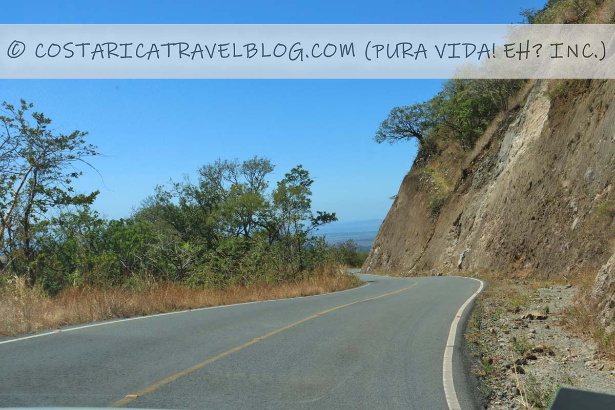
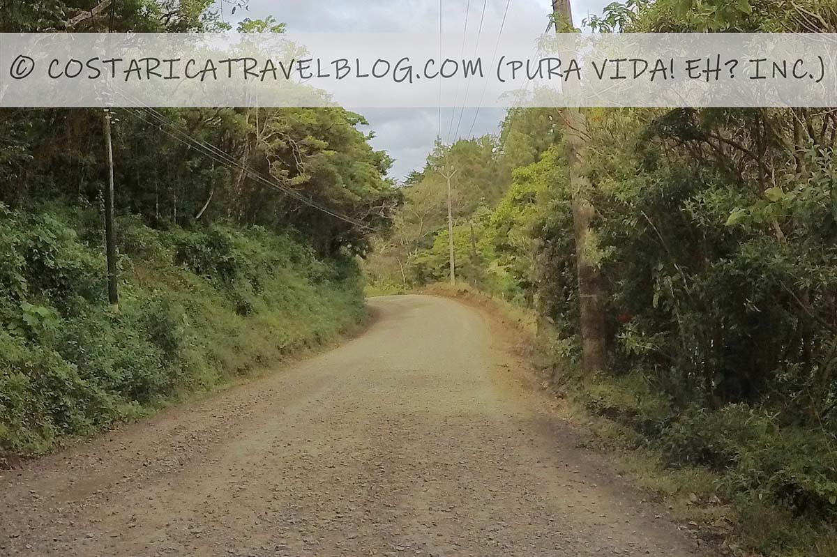
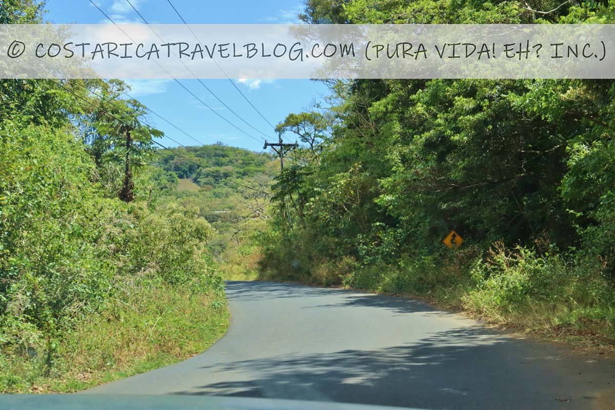
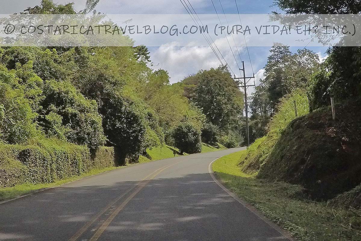
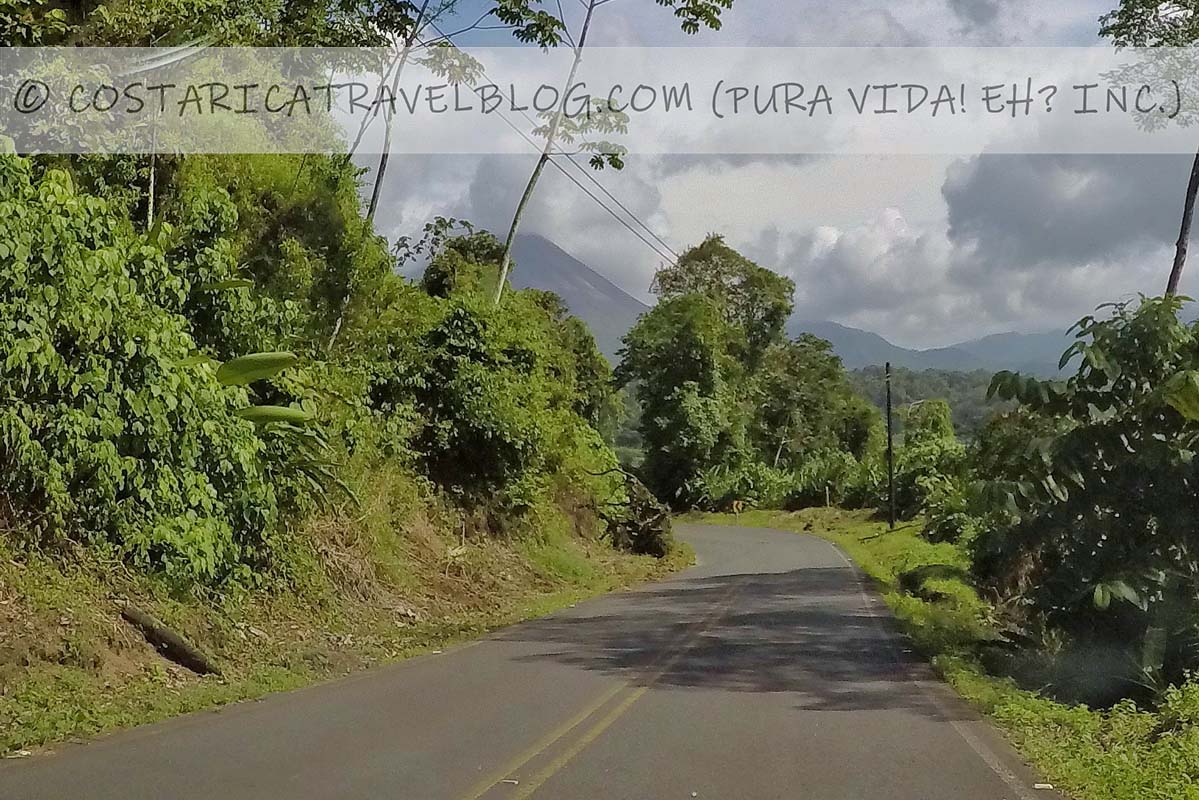
Road 142 / Road 145 (northwest of Monteverde) / Road 606 (north of Monteverde)
Road 606; north of MonteverdeRoad 142Road 142Road 142Road 142Road 142 Road 142Road 142 View from Road 142
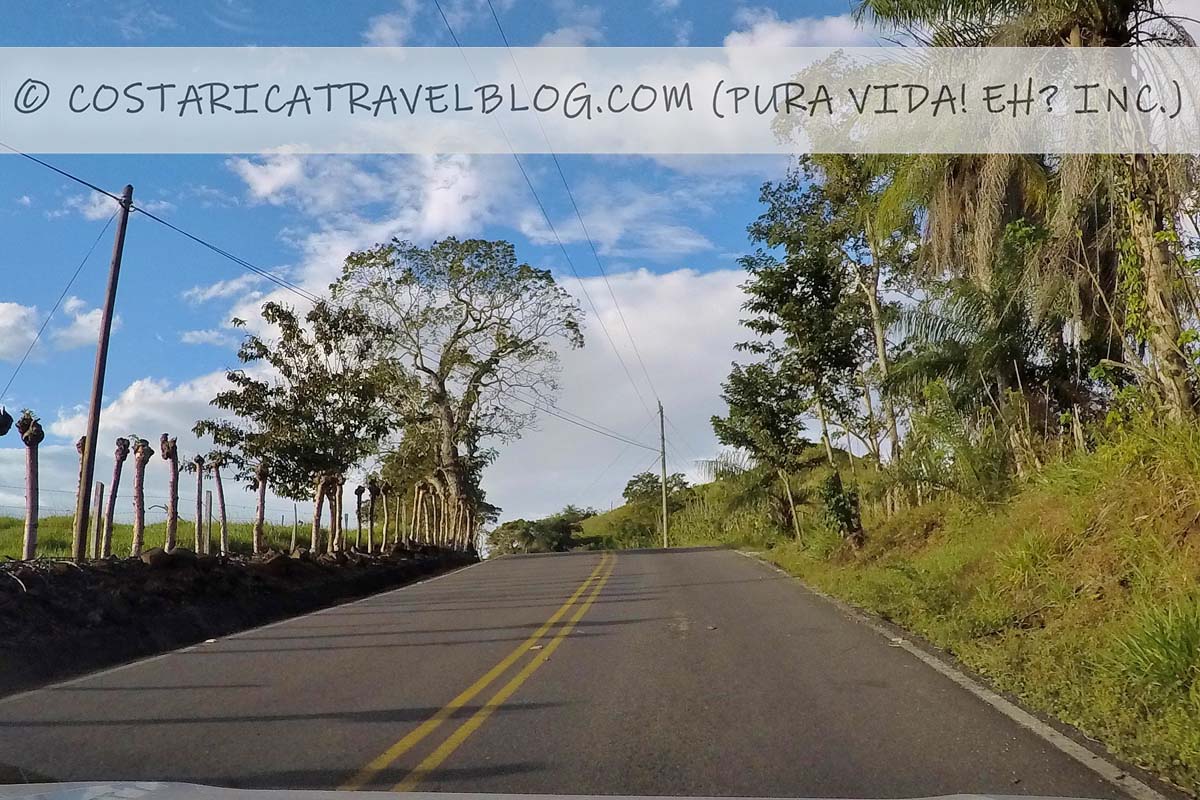
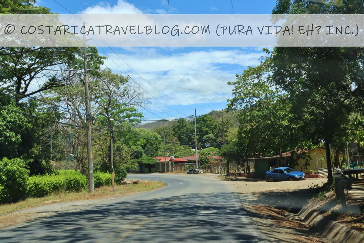
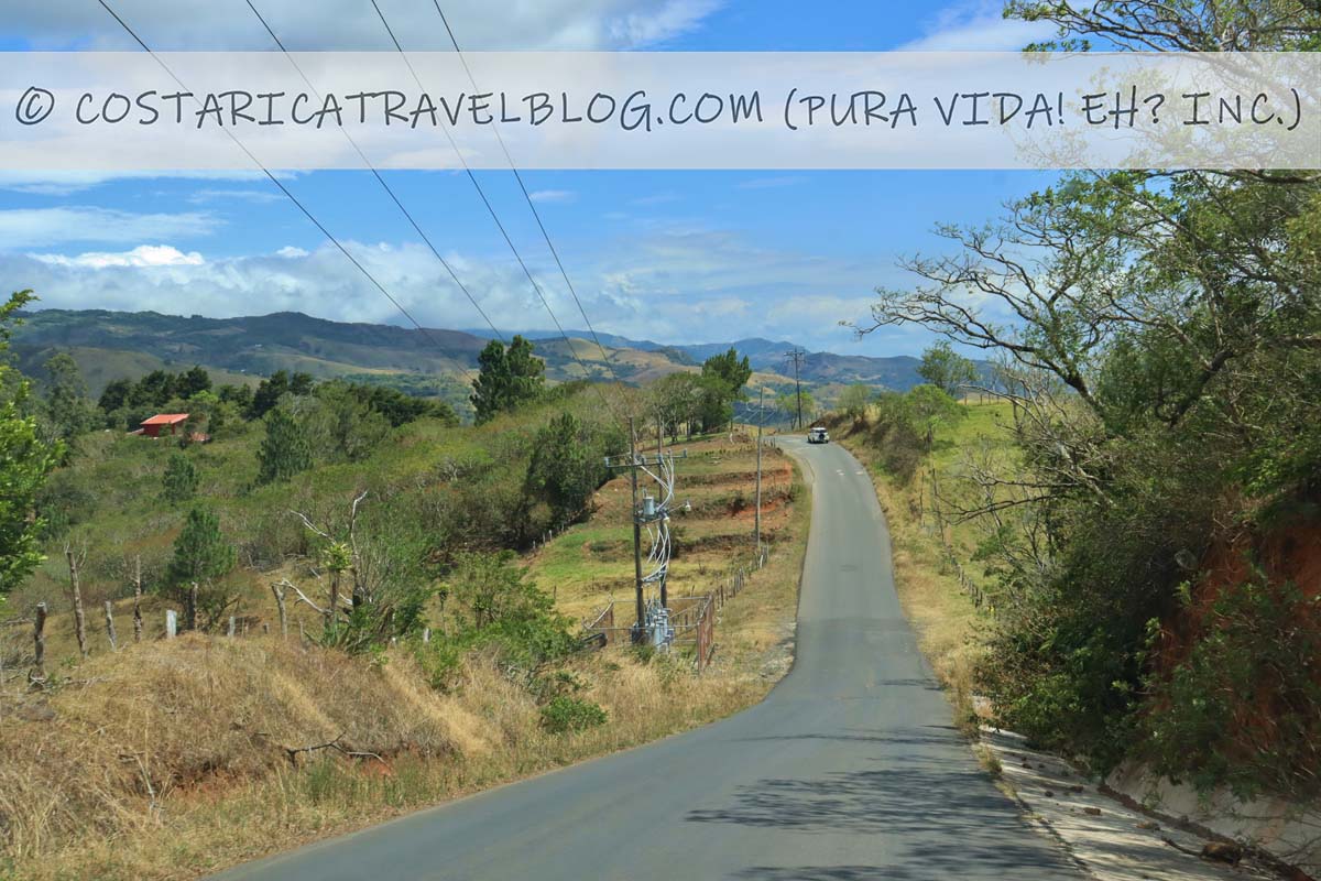
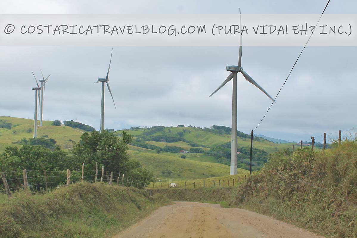
If you plan to enter Monteverde from the north, you’ll drive a series of roads (Road 142, Road 145, and Road 606) that weave around mountains and through communities. Together, they provide a fairly curvy but easy drive over paved and pressed-gravel roads. The roads can be narrow in areas, so it’s important to approach curves with caution; some local drivers whip around corners with little concern for oncoming traffic. To avoid damage to rental vehicles caused by pops of gravel, drive at a slow pace. Also, drive slowly when it’s raining or has recently rained; pressed-gravel roads can become slick when wet, making the drive extra slippery.
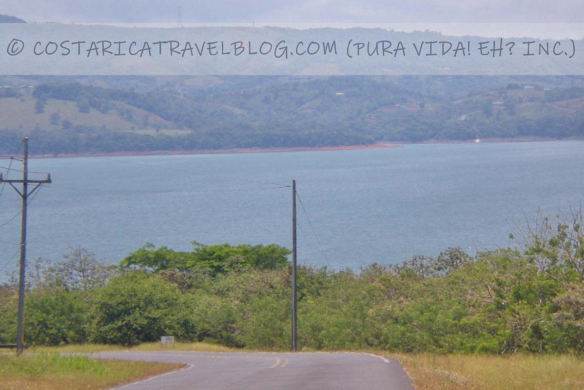
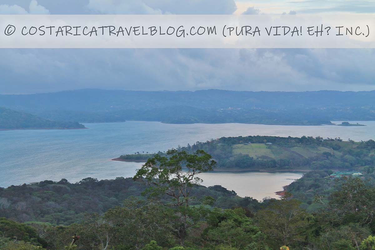
If you plan to drive to Monteverde from La Fortuna: You’ll first drive the section of Road 142 that departs from downtown La Fortuna. (Road 142 is best known for being downtown La Fortuna’s main drag.) The road runs east-west through La Fortuna then continues west out of La Fortuna, curves around the Arenal Volcano, and skirts around Lake Arenal, passing through the community of Nuevo Arenal along the way. In the town of Tilaran, a turn onto Road 145 is required to continue driving to Monteverde. Roughly 20 kilometers down the road, another turn (onto Road 606) is required; Road 606 leads directly to Santa Elena (downtown Monteverde).
If you plan to drive to Monteverde from Liberia or a destination on the northern Pacific coast: You’ll take Highway 1 as far as the town of Canas, where you’ll connect with Road 142. In the town of Tilaran, you’ll turn onto Road 145, and eventually (roughly 20 kilometers down the road), onto Road 606. Road 606 leads directly to Santa Elena (downtown Monteverde).
The following details reflect the combined route of Road 142, Road 145, and Road 606:
Alternative road names: La Fortuna’s main street (Road 142); the road around the Arenal Volcano (Road 142); Nuevo Arenal’s main street (Road 142); the road to Tilaran (Road 142); Avenida 1/Avenida Central in Canas (Road 142), the road to Monteverde (Road 145); the road to Monteverde (Road 606)
Popular destinations encountered along the route: La Fortuna (Road 142); Viento Fresco Waterfalls (Road 145)
Off-the-beaten-path destinations encountered along the route: Nuevo Arenal (Road 142), Tilaran (Roads 142/145), and Canas (Highway 1/Road 142)
Road conditions and design: single-lane road; paved in places and pressed gravel in places
Terrain: primarily flat between La Fortuna/Canas and Tilaran; mountainous between Tilaran and Monteverde; curvy in places
Pace: moderate; slower around sharp curves
Traffic: moderate; heavier in downtown La Fortuna, Canas, and Tilaran
Flow: two-way road
Tolls: none
River crossings: none
4×4 vehicle required: not required but recommended
Special notes and advisories: Take curves slowly, especially when driving after dark; watch for CEDA (yield) signs; enjoy views of the Arenal Volcano along Road 142 between Tilaran and La Fortuna; be mindful of turns required to stay en route to Monteverde
Driving to Monteverde: Duration and Distance Chart
Planning to drive to Monteverde from one of Costa Rica’s most popular destinations? Our chart below outlines the route, distance, and approximate duration for each trip to Monteverde.
Driving to Monteverde from…
via…
is roughly…
and takes approximately…
San Jose
Via the route from the southeast: Highway 27, Highway 23, Highway 1, and Road 606
145 kilometers
3 hours
Liberia
Via the route from the north: Highway 1, Road 142, Road 145, and Road 606
110 kilometers
2.5 hours
Liberia
Via the route from the southwest: Highway 1, Road 145, Road 606
110 kilometers
2 hours and 15 minutes
Liberia
Via the route from the southeast: Highway 1 and Road 606
140 kilometers
2.5 hours
La Fortuna / Arenal
Road 142, Road 145, and Road 606 *This route avoids a boat ride across Lake Arenal
115 kilometers
3-3.5 hours
La Fortuna / Arenal
Via combined ground-boat-ground transfer *This route requires a boat ride across Lake Arenal
Do you have questions about the roads that lead to Monteverde, want to know which route is the best for you to take, or need help discovering some cool places to stop at along the way? No problem! When you’re ready, make an appointment here to communicate with me (Nikki) privately and we can discuss these and other topics to get your questions answered fast and your Costa Rica trip poised for success. Pura vida, amigos! 🙂
Hey, Costa Rica Travel Blog reader, thank you for visiting and reading our blog! We're truly grateful for your time and preference.
Do you know that your spam-free reading experience is most important to us? Unlike some other Costa Rica blogs, we do not to sell your personal information, and we choose not to display ads, sponsored content, or affiliate marketing on our blog so we can keep your visit as distraction- and junk-free as possible. Because we prioritize your privacy, we don't earn money when you visit us, when you sign up for our e-course, or when you click on our links, which means the time and work we put into this blog—including its 300+ articles—is entirely voluntary! If you find our content valuable, and you'd like to thank us for making the trip-planning process easier and your Costa Rica vacation more enjoyable, please consider making a small donation ($1, $2, $3, or an amount of your choosing) to our blog. Doing so is a great way to pat us on the back if you feel we deserve it. 😊 Pura vida, amigos!
Click on the button above to donate through PayPal. (If you cannot see the PayPal button above, click here.) A PayPal account is not required to make a donation; credit and debit cards are also accepted. PayPal donations are confidential; we never see your payment details.
Love our blog? Check out our other Costa Rica-related projects, too:
Summary
Article Name
Driving to Monteverde: Photos, Road Conditions, Routes, Drive Times, And More!
Description
Everything you need to know about driving to Monteverde: possible routes, road descriptions, a distance/duration chart, and more!
The comment section of this article has moved! If you have a question or comment about our article above or Costa Rica travel in general, please post it in our Questions and Answers Forum on DIY Costa Rica, our sister website, where you can also access our private Costa Rica recommendations, our Costa Rica Destination Tool, and our Costa Rica Recommendations Map. See you there, amigos! 🙂
Author
Posts
Viewing 1 reply thread
The forum ‘Costa Rica Travel Blog Forum’ is closed to new topics and replies.
The LATEST: Prefer learning by listening, not reading? We're now on Spotify! Listen here. The GREATEST: Humbly, this is the best Costa Rica blog. Discover why here. Pura vida, amigos!


Tagged: driving in costa rica